

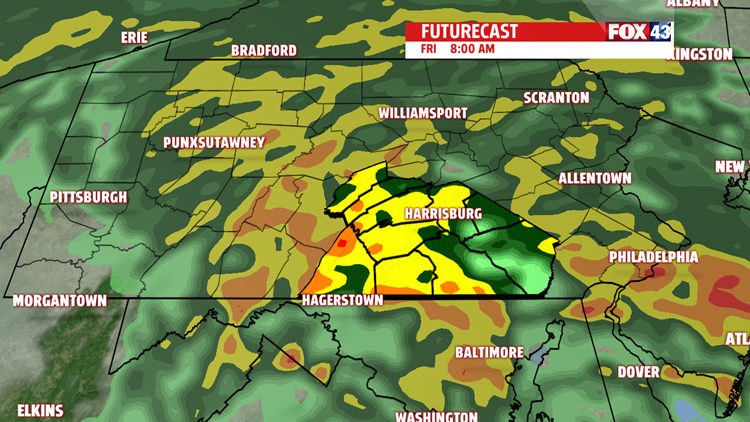
PERIODS OF HEAVY RAIN FOR FRIDAY

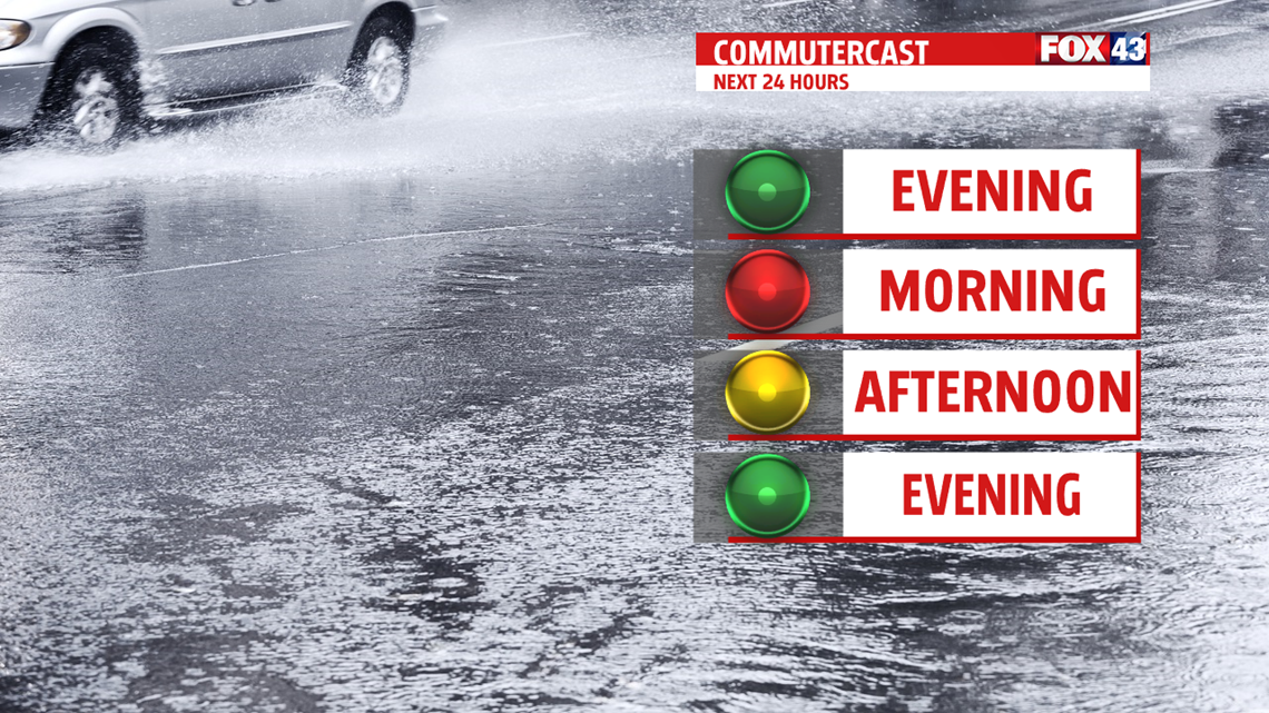
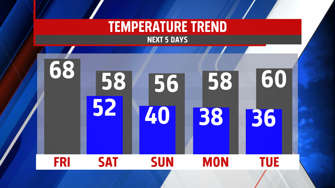
This evening skies are cloudy with showers developing late. Rain becomes more widespread overnight and picks up in intensity at times. Temperatures fall from the 60s into the 50s by morning. Winds are expected to be strong and gusty early in the morning. Rainfall amounts may exceed 1 inch. Minor flooding is a concern Friday

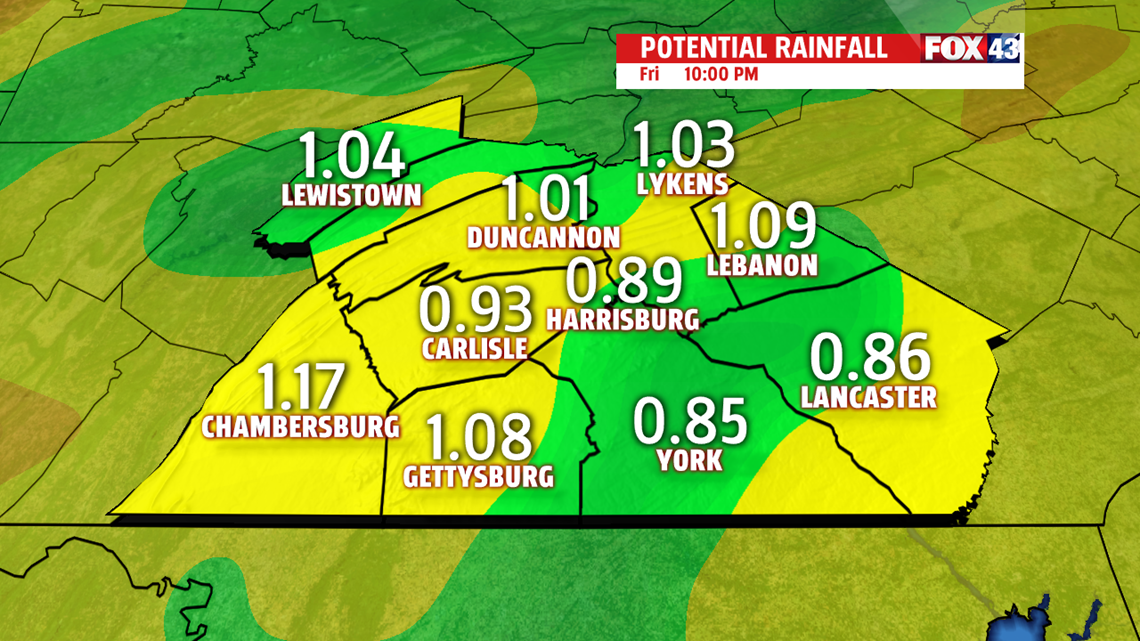
and Friday night along small creeks and streams, poor drainage areas, and low-lying areas. Isolated thunderstorms are possible too. They may contain strong damaging winds so the Storm Prediction Center placed

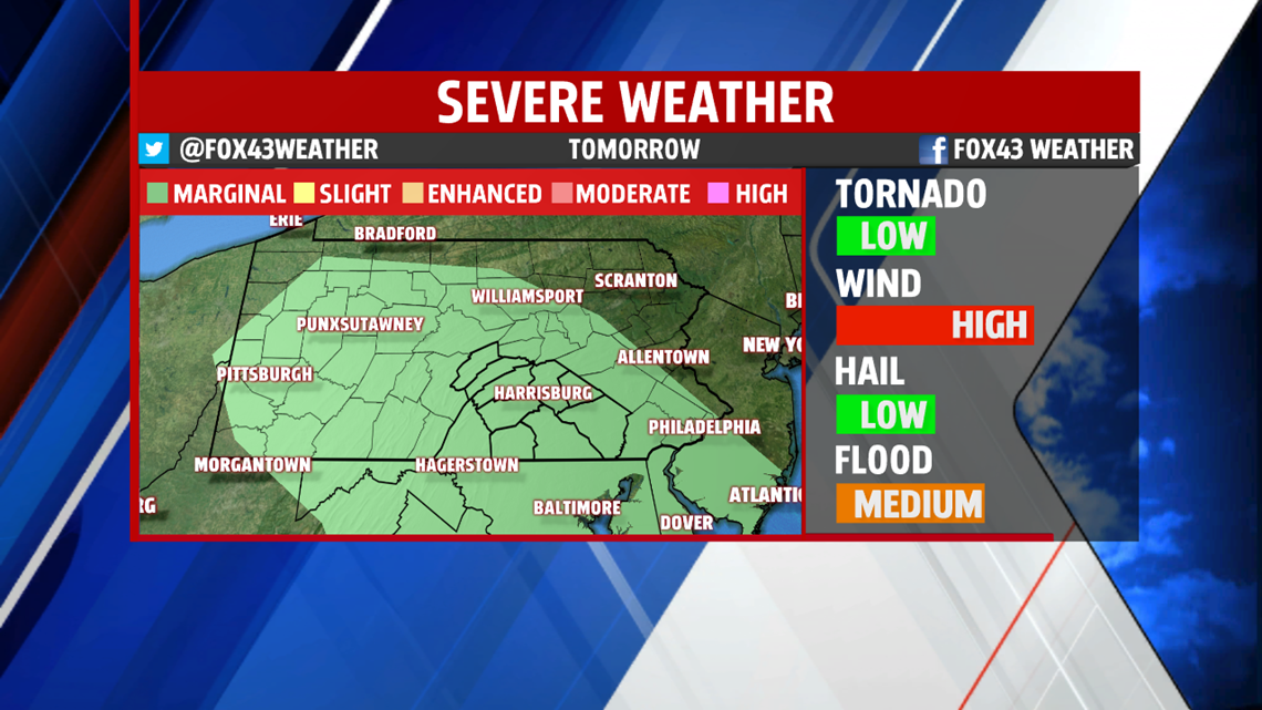
the area under a MARGINAL risk for severe weather during the afternoon and early evening. The risk is low but we’ll need to keep an eye on things. We get a spike in temperatures to the upper 60s, with a few spots hitting 70 degrees. Spotty showers continue overnight with morning lows only dropping to the lower 50s.
UNSETTLED, COOL WEEKEND
A system stalls over the area this weekend keeps plenty of clouds around. A few showers are possible at the beginning of the weekend with only isolated chances Sunday. Readings are cool in the 50s both days. Winds are expected to be breezy adding to the already chilly temperatures.

NEXT WEEK
Upper level system starts to lose it’s grip on the area Monday. We’ll see a bit more sunshine mixing in and out of the clouds. An isolated shower is possible but chance is very low. Temperatures are slow to recover and remain well below average. You can expect temperatures to remain in the 50s Monday and Tuesday. We’ll see a tick up in temperatures for Wednesday and Thursday, however, showers will return to the area both days.
Have a wonderful day!
Be “Weather Smart” and watch FOX43 for all your weather and news updates.
MaryEllen Pann,
Chief Meteorologist
