

A DIP IN TEMPERATURES IS BRIEF
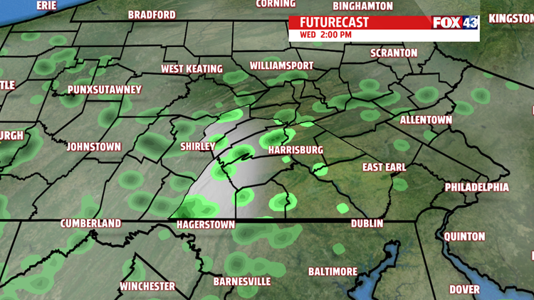
After a beautiful day, we end it with a few showers and perhaps a pop up thunderstorm or two.

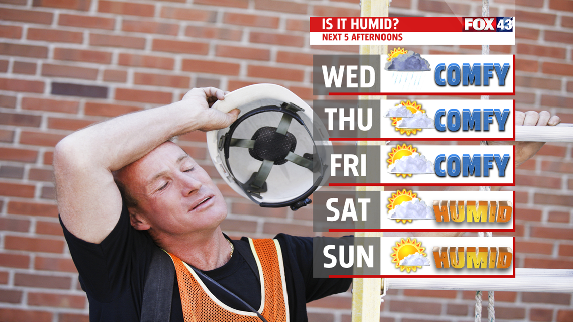
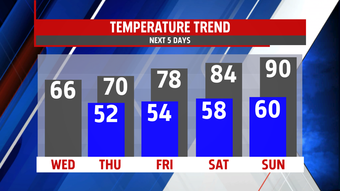
Clouds take over the next couple of days, limiting sunshine, and keeps temperatures cooler than average in the 60s. You’ll notice it’s more comfortable with lower humidity. A few showers are

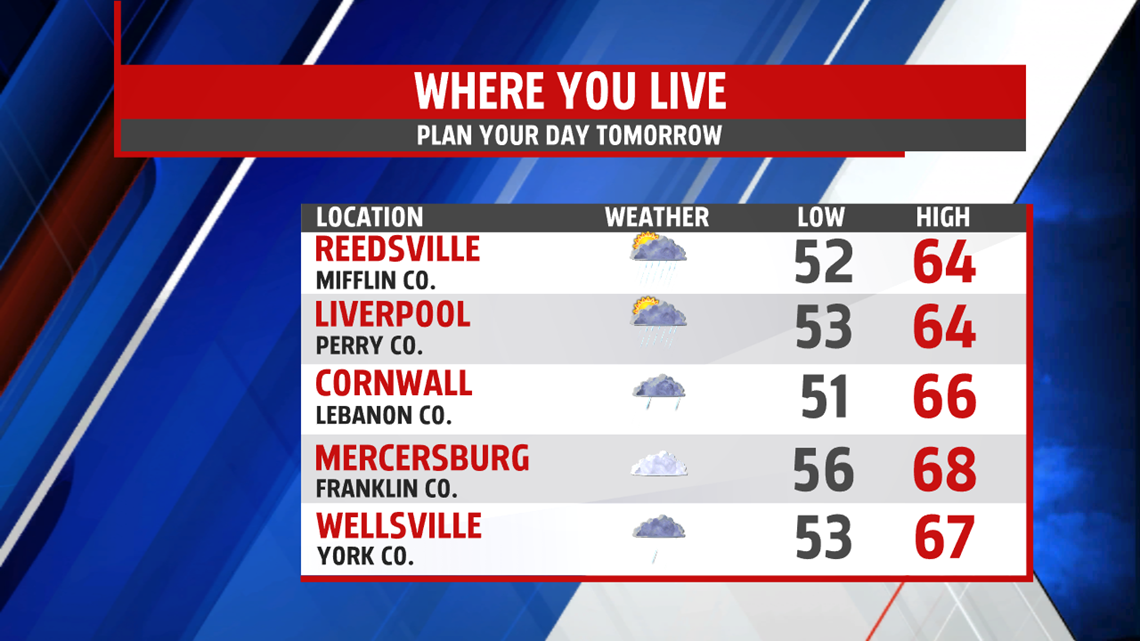
possible but there will be plenty of dry hours too. Temperatures
start to rebound by the end of the week as sunshine increases. Highs are back into the middle and upper 70s Friday. A small shower chance is still present.
HAZY, HOT AND HUMID ARRIVES OVER THE WEEKEND
We welcome summer-like weather by Sunday. Saturday, expect skies to be partly cloudy. A stray thunderstorm could pop up as a weak disturbance swings through. Strengthening high pressure in the Atlantic, known as a Bermuda High, provides a strong southwest flow. It will pump in much warmer air and more moisture too. Highs soar to the upper 80s to near 90 degrees. The heat and humidity continues into early next week with highs in the lower 90s for Monday and Tuesday. Storms arrive Wednesday, knocking temperatures down a few degrees.

Stay “Weather Smart” with the FOX43 Weather team!
Have a good day!
MaryEllen Pann,
Chief Meteorologist
