

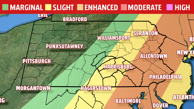

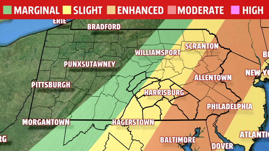
SEVERE THREATS MONDAY: An ENHANCED risk of severe weather is in effect for parts of York, Lancaster and Lebanon counties, a 3 on a scale of 1-to-5. A SLIGHT risk is in effect for portions of York, Lebanon, Dauphin, Adams, Cumberland, Perry, Juniata and Franklin county; a 2 on a scale of 1-to-5. A MARGINAL risk for severe weather is in effect for portions of Juniata and Mifflin counties; a 1 on a scale of 1-to-5.
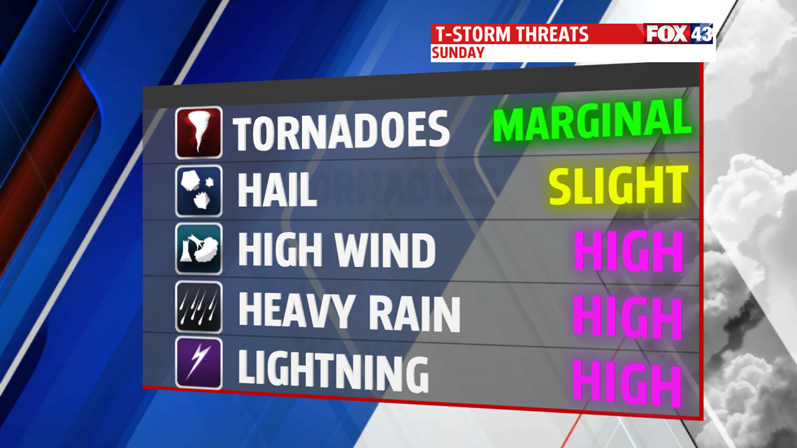
The main threats Monday will be winds gusting above 60MPH, heavy rain that may cause both flash flooding and river flooding, lightning and small hail. The tornado threat is low, but it’s not zero.

TIMING OF STORMS: A few thunderstorms will pop-up throughout the morning hours with heavy downpours. The best chance of thunderstorms starts around noon and lasts throughout the afternoon and into the early evening. These storms will intensify throughout the afternoon as the main line moves east-to-west across Central PA with a passing cool front. We dry out heading into the overnight hours.

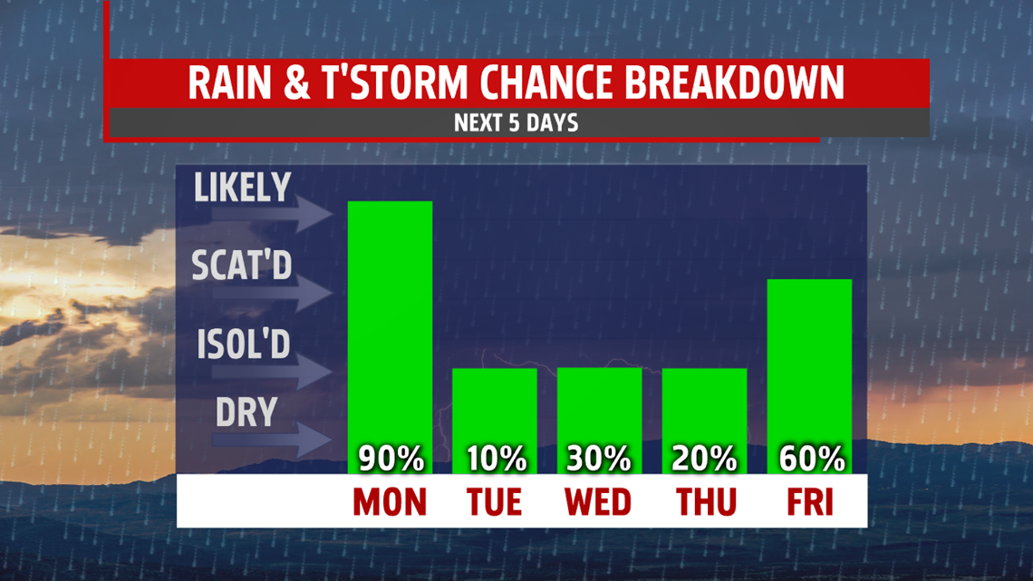
DRYING, THEN MORE STORM CHANCES: We stay dry for Tuesday with highs in the low 80s. The rest of the week has off-and-on low thunderstorm chances with lows in the low-to-mid 60s through Thursday and highs in the mid-to-upper 80s. Scattered thunderstorm chances come back Friday with highs in the low 90s.
Stick with FOX43 on-air, online and with the FOX43 Weather App for the latest on our severe weather chances. We’ll give you the information you need to be Weather Smart!
Have a wonderful rest of your Father’s Day!
-Meteorologist Bradon Long
