

ENDING THE WEEK WITH THUNDERSTORMS


The muggy conditions have returned and remain for a couple of days. We could see few thunderstorms bubble up this afternoon and evening as a warm front lifts north. In our northwest counties, storms may contain damaging winds and severe hail. The threat is low but exists. Then we get a break before another round of showers arrives in the morning. It’s a sweaty night with lows in


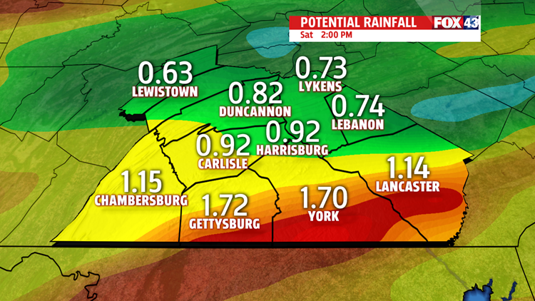
many areas staying in the 70s. Showers and thunderstorms return for Friday. First wave arrives during the late morning rush hour. Then showers and thunderstorms are scattered on and off through the day and the evening. The Storm Prediction Center placed the area in a Marginal Risk for severe weather. This is the lowest risk however, some storms could become severe. Gusty winds, small hail and

heavy downpours possible. Short-lived flooding with the storms is possible too. Amounts in some areas may exceed an inch of rain or more. High temperatures are well into the 80s but feeling like the 90s with the humidity. Expect the storm activity to continue through the evening and overnight period. More showers move through in the early morning hours Saturday.
MAINLY DRY AND MORE COMFORTABLE FOR THE WEEKEND
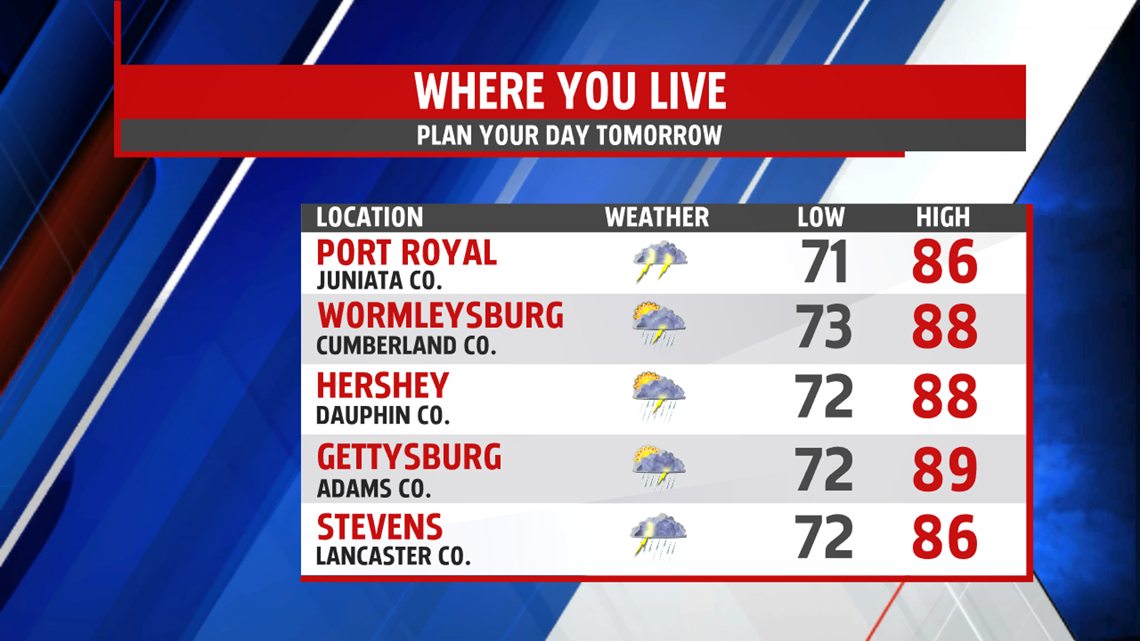
It’s another toasty start to the day. Muggy too. After morning showers, I expect a mainly dry weekend. We should be done with the wet weather early Saturday. The rest of the day, skies slowly improve. Humidity drops and so do the temperatures. Readings are still quite warm in the middle 80s Saturday but drop to the lower 80s Sunday. Skies are brighter the second half of the weekend with less cloud cover.
COOLING NEXT WEEK
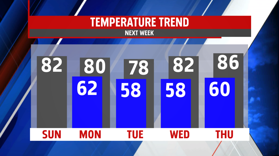
We begin the week mainly dry with cooler than average readings. An isolated shower or two is possible Monday but most areas stay rain free under partly sunny skies. The first full week of summer won’t feel typical initially. Highs only manage the upper 70s to near 80 for a couple of days. Readings finally rebound to the middle 80s by Thursday. It is a fairly dry stretch with the shower and storm threat holding off until the end of the week.

Stay “Weather Smart” with the FOX43 Weather team!
Have a good day!
MaryEllen Pann,
Chief Meteorologist
