

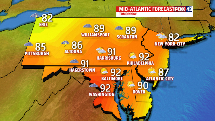
TURNING STICKY AND HOT

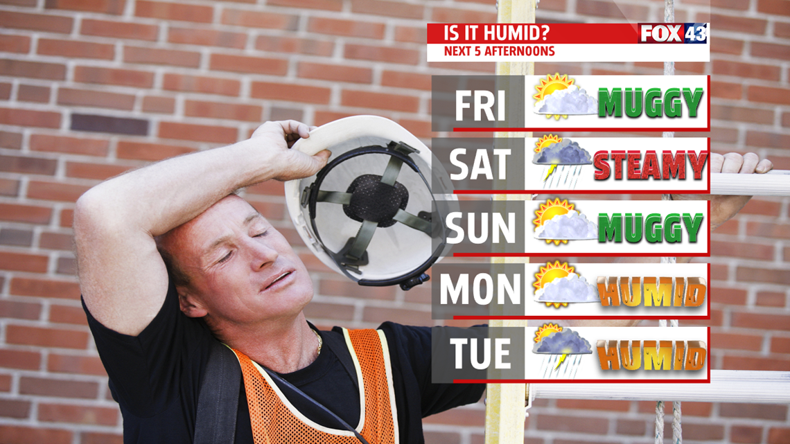
STEAMY WEEKEND


NEXT WEEK
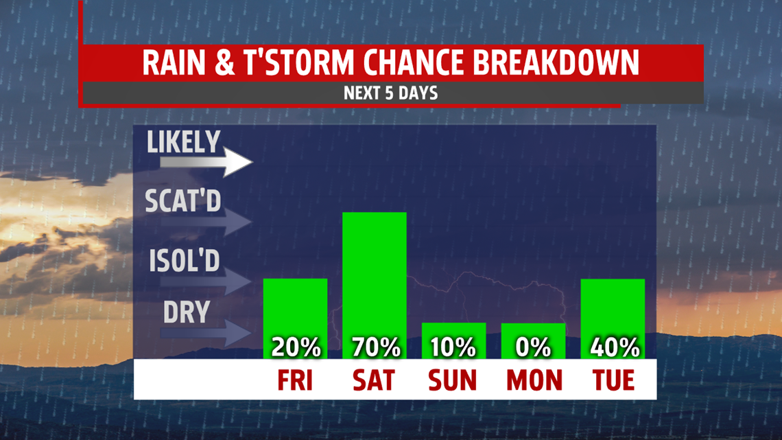
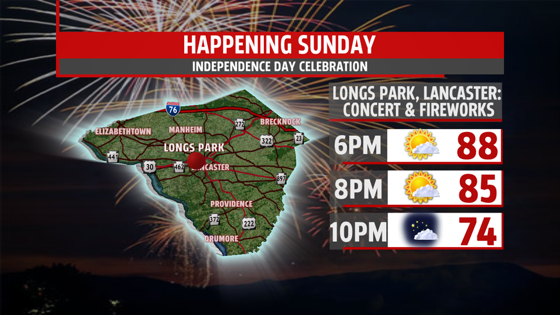
Monday is dry but warm and humid with highs in the upper 80s. A warm front attempts to move across the area Tuesday bringing the threat for a few storms for Fourth Of July. However, I wouldn’t cancel fireworks. By dusk, storms which develop, will have moved out of the area. With the added cloud cover and threat for storms, readings are in the middle 80s. It appears right now the front gets hung up keeping afternoon thunderstorms a possibility for Wednesday and Thursday. Afternoon highs remain warm and a tad above average in the upper 80s.
Stay “Weather Smart” with the FOX43 Weather team!
Have a good day!
MaryEllen Pann,
Chief Meteorologist
