

HAZY, HOT, AND HUMID


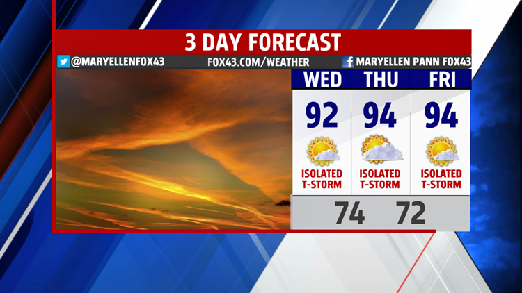
This evening is very warm and sticky with a few isolated thunderstorms. Temperatures fall through the 80s. Overnight, expect a hazy start to the day Wednesday with lows in the lower 70s. While most of the day is just hot and humid, a stray


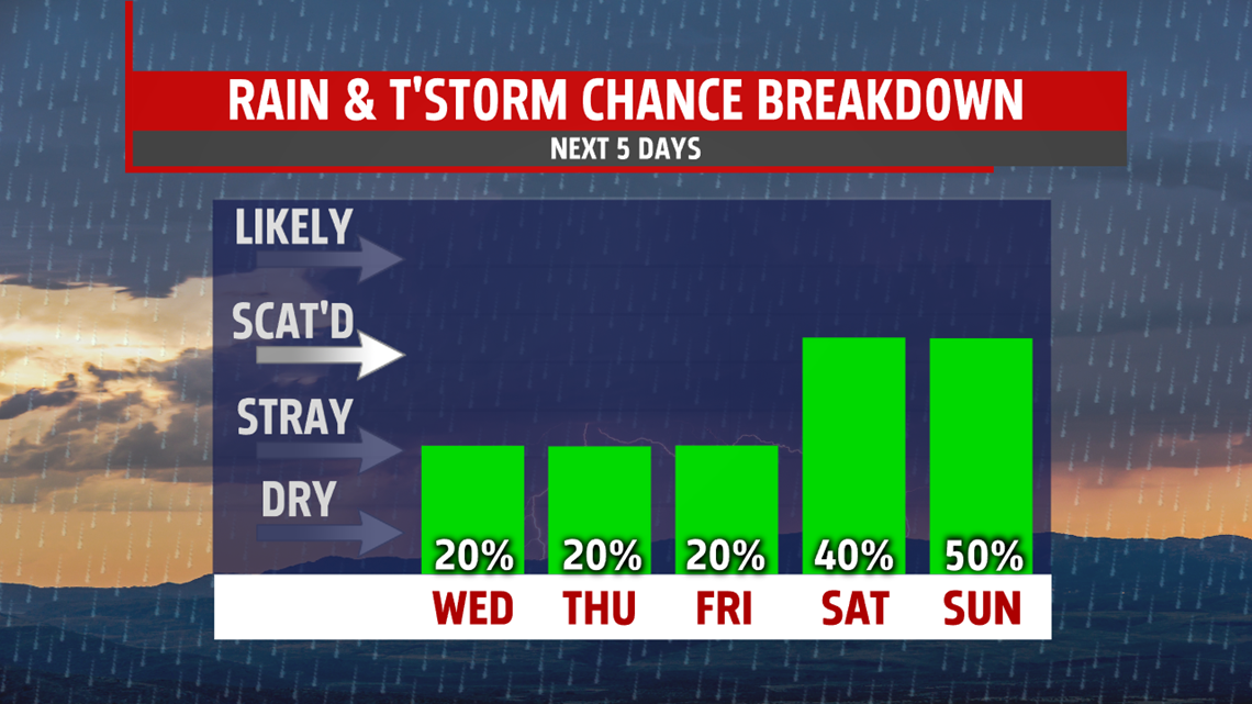
thunderstorm can’t be ruled out. Same goes for Thursday. High temperatures top out the lower 90s both days, with mid 90s more likely mid-week. We’ll be talking about the heat index quitea bit this week as readings could touch 100 degrees. That is what it will feel like with the humidity factored in. Storm chances are isolated but by the end of the week and into the weekend, a few more are expected during the afternoon and early evening. Heavy downpours are likely with the storms, however, most areas won’t have to worry about flooding. It remains hot in the lower 90s Friday.
WEEKEND OUTLOOK
Threat for showers and thunderstorms increases a bit into the weekend. It is not a washout by any means but you’ll need to keep an eye to the sky. Temperatures will continue hot, touching 90 both days.

TEMPERATURES FALL BACK
A break from the extreme heat is expected as a cold front sweeps across the area Monday. It will bring widespread showers and thunderstorms too. Readings return to the 80s and we finally see drier conditions move in for Tuesday.
Stay “Weather Smart” with the FOX43 Weather team!
Have a good day!
MaryEllen Pann,
Chief Meteorologist
