


HOT AND HUMID END: We continue to see the very low chance of an isolated shower and thunderstorm by the afternoon and into the early evening. Temperatures today reach the low-to-mid 90s with heat indices in the upper 90s under otherwise mostly sunny skies.

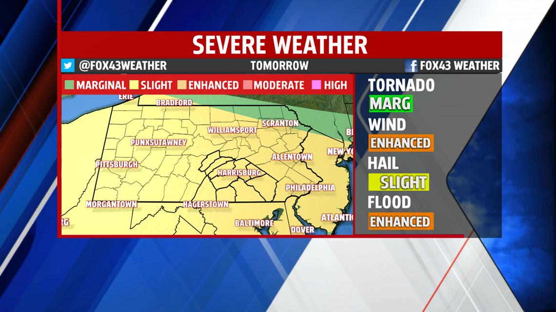
SLIGHT RISK SATURDAY: A SLIGHT risk for severe weather is in effect for Saturday, a 2-out-of-5 threat. Thunderstorms will develop in the early afternoon and continue throughout the early evening as highs reach the low-90s. These storms will have very heavy rain, wind gusts above 60MPH and could see some small hail up to the size of quarters. The tornado threat for Saturday is very low.

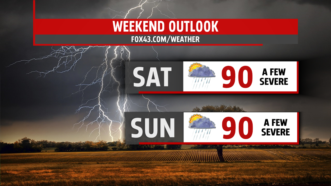
MORE FOR SUNDAY: More severe thunderstorms will be possible for Sunday with highs hovering around the 90-degree mark. In a similar setup to Saturday, storms could develop in the early afternoon throughout the mid-evening hours. Heavy rain, lighting and small hail will be the main threats, but the tornado threat, while still low, is slightly higher.
The overall chance for severe weather is still low, but I’ll be in all weekend long keeping an eye on the radar as we head through the weekend. Keep the FOX43 Weather App handy and stay tuned on-air and online for the latest updates. We’ll give you the information you need to be Weather Smart.
Have a great Friday!
-Meteorologist Bradon Long
