

STILL NICE, MORE CLOUDS: After another cool start in the upper-40s, highs once again reach the low-70s under mostly sunny skies by mid-afternoon. Heading into the evening, cloud cover begins to take over the area with a light north wind, but we stay dry.


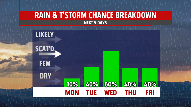
OFF AND ON RAIN: Rain chances associated with little waves of energy from Irma will be all we feel throughout the week of the weakening storm. Our winds stay light with rain totals staying under an inch for most places throughout the week. We see our best chances of rain Tuesday night into Wednesday morning with highs staying in the low-to-mid 70s. Our rain chances remain consistent, but low throughout the week. We do see rain in Central PA every day starting Tuesday, but the chance you see them out your specific door is low.
TRACKING IRMA AND JOSE: As of 8:00PM Eastern Time, Hurricane Irma is tracking up the West Florida coast as a strong Category 2 hurricane with constant wind speeds near 110MPH. Irma is expected to continue to skirt the coast and head up into Georgia and eventually hover in the Midwest as an ordinary low pressure system. She’ll head our way heading into next weekend, but will be hardly be a blip on our radar finishing the week.

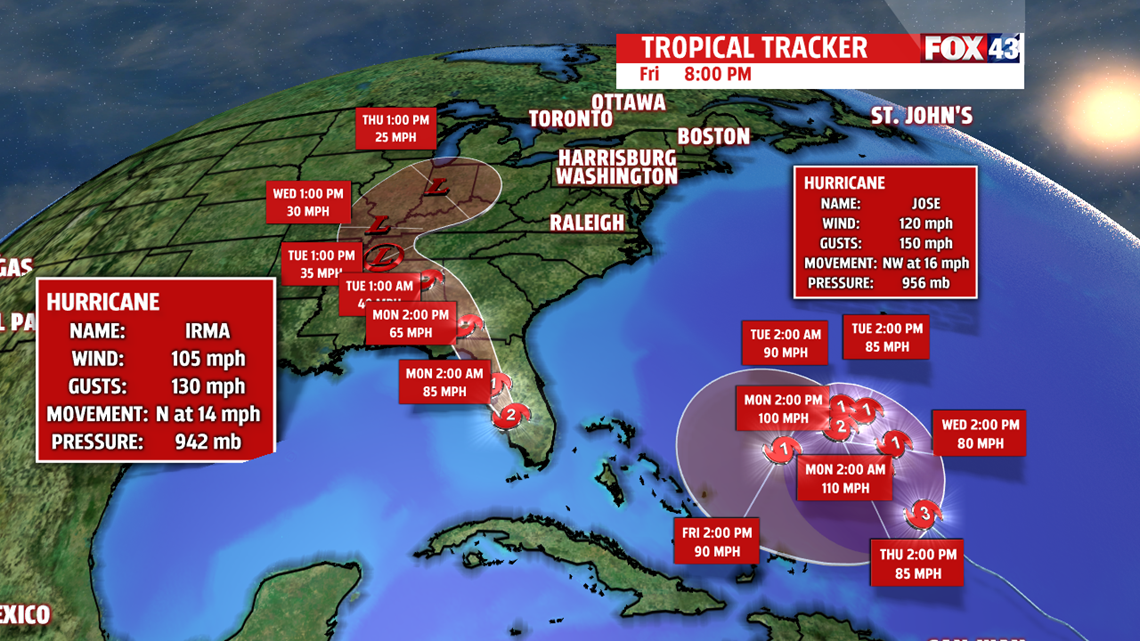
We’re also keeping our eye on Hurricane Jose, who’s path will circle in the Atlantic for most of the week before current projections have the storm turning back towards the United States. However, current long-range models have the hurricane continuing to stay well out in the Atlantic and weaken in cooler waters. This is still well too far out to give an accurate projection with any certainty whatsoever, so stick with us as we track the remaining life of Hurricane Irma and head into next week.
Have a great one!
-Meteorologist Bradon Long
