


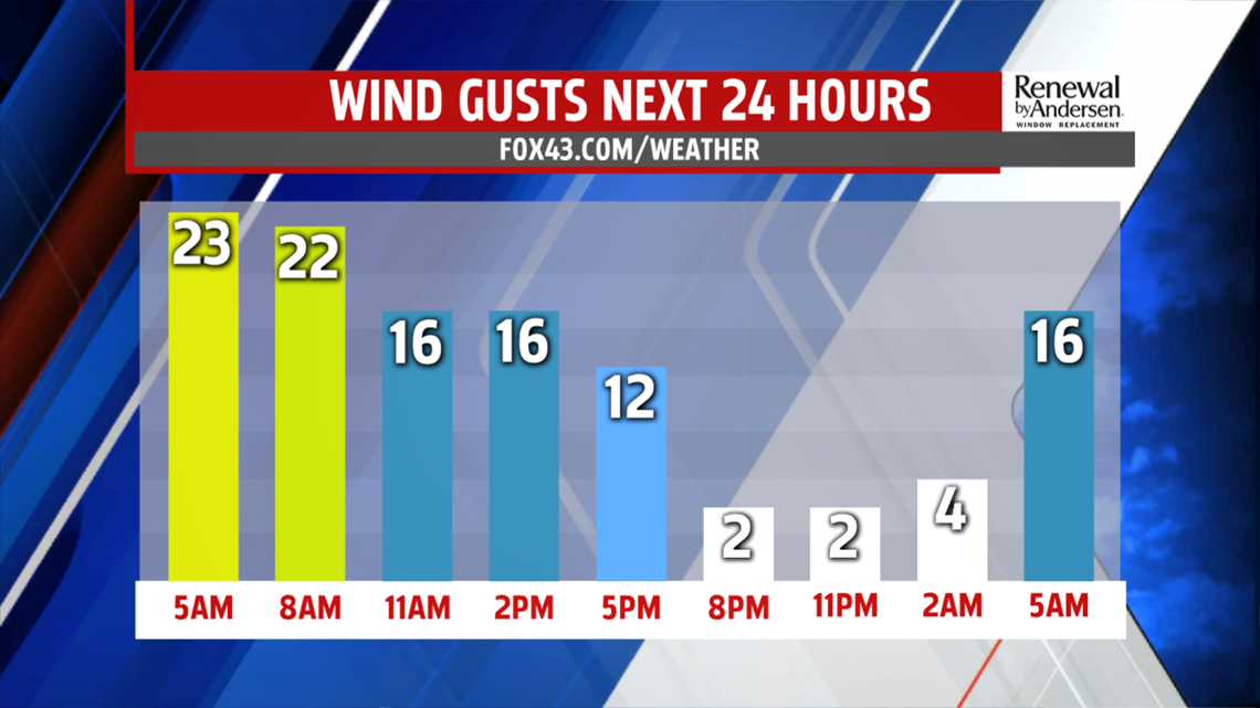
OUT THE DOOR FRIDAY: We start breezy with gusts up to 30MPH throughout the morning and into the early afternoon. This means our "feels-like" temperatures will be well into the 20s for the morning, with our actual morning lows in the 30s. The breeze will begin to calm by the early afternoon as highs reach the upper-40s and low-50s.


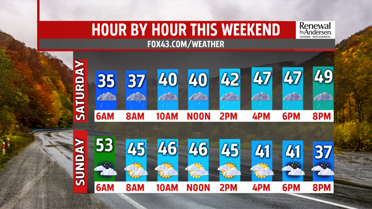
HEADING INTO THE WEEKEND: Clouds increase overnight ahead of our next rain maker for Saturday. Showers begin to take over in the mid-morning hours and last off-and-on throughout the day. Everybody sees rain, but overall totals remain light for most areas, with locally higher totals possible. Regardless, most of the day is cloudy and dreary.

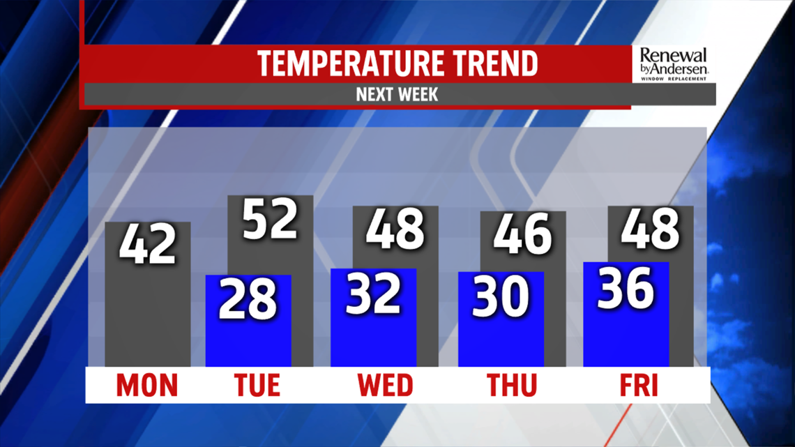
STAYING COOLER: Highs drop into the low-40s to finish the weekend and start the work week. Flurries are possible, especially in the morning hours, both Sunday and Monday with breezy conditions. The wind chills both mornings drop well into the 20s once again. Heading to the holiday, we remain dry with temperatures rising to around the 50-degree mark for most of the week.
Have a great day!
-Meteorologist Bradon Long
