


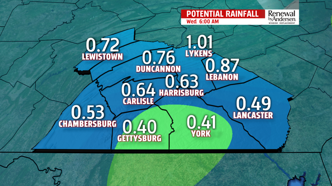
RAIN ALL DAY: Morning lows drop around 40. A few off-and-on light showers are possible in the morning hours, with the bulk of steady rain holding off until Noon. Showers blanket Central PA for the afternoon and into the evening. Highs top out in the mid-50s with breezy southwest winds near 10MPH. Winds switch overnight, bringing in colder air.

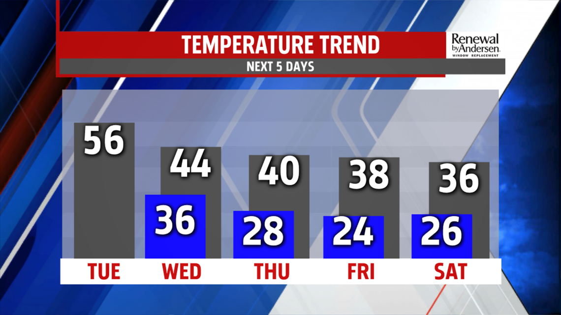
COLD AIR: We’re cooler for Wednesday as temperatures hover around 40 for most of the day. Highs are in the early afternoon in the low-to-mid 40s. Thursday is colder in the upper-30s and low-40s as temperatures steadily drop to the mid-to-upper 30s for highs throughout the rest of the Weather Smart Forecast this coming weekend.

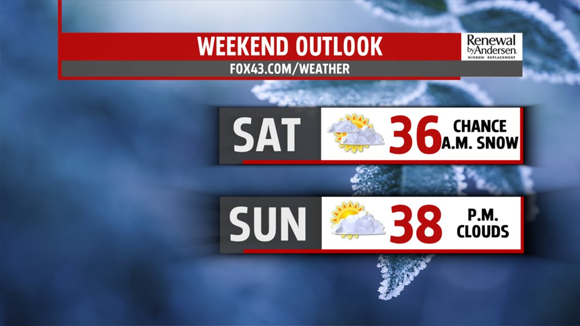
SNOW? MAYBE THIS WEEKEND: We’re cold Saturday morning, with lows in the mid-20s. A few flakes are possible, with light accumulation possible in our far western counties. Most of us just see a dusting for our first snowfall of December. Chances are low, especially this far out, but possible. Don’t change any plans, just be watching as we get closer to time.
Have a great one!
-Meteorologist Bradon Long
