

TEMPERATURES TURN CHILLIER
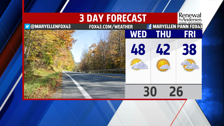
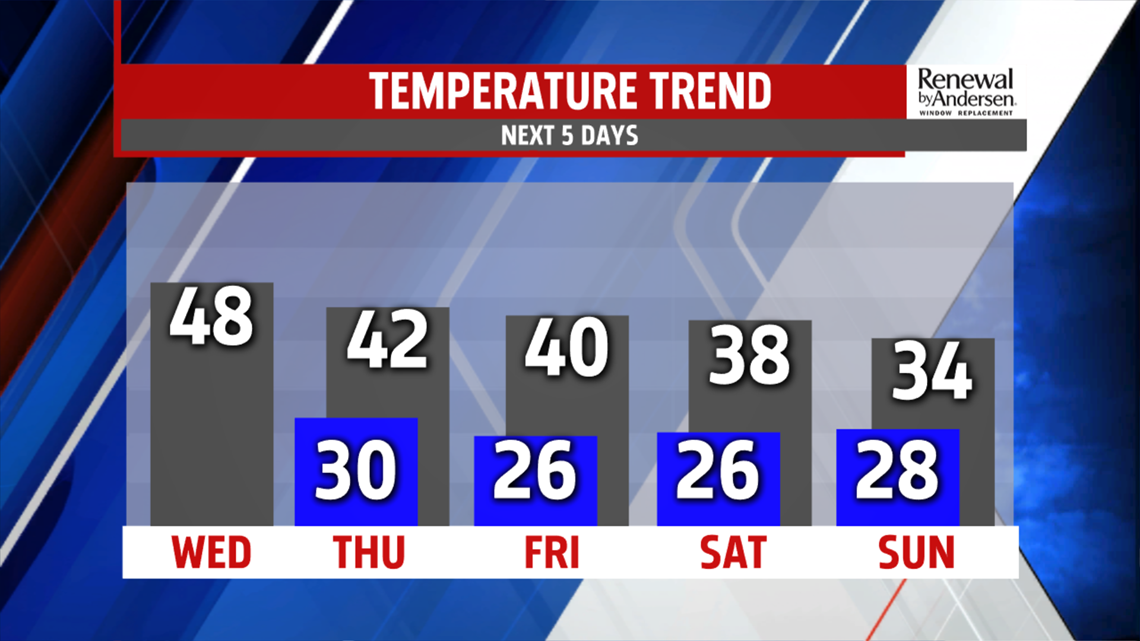
Rain tapers to showers through the late evening. Drier weather starts to work in from the west after 9pm. Temperatures are mild in the 50s but plummet by Wednesday morning to the upper 30s. Afternoon readings are seasonable in the lower and middle 40s. A breeze, out of the west 5-10 mph, adds to the chill. After a sunny morning, a few clouds bubble up during the midday, before clearing by late afternoon. Thursday is chillier despite more sunshine. Temperatures top out in the lower 40s. We trend even colder Friday with more clouds and readings only in the upper 30s to near 40 degrees. A stronger upper level wave swings through to bring a shot of Arctic air and light snow showers.

WEEKEND OUTLOOK
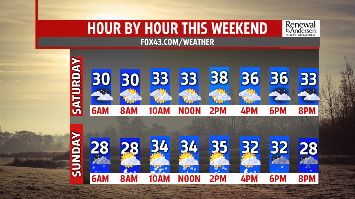
It’s cold in the middle and upper 20s Saturday morning. Clouds mix with sunshine through the day. Bundle up, temperatures only recover to the upper 30s. With a much colder air mass, and strong upper level energy arriving overnight into Sunday, a few snow showers are possible early. Temperatures only rise to the lower and middle 30s.

NEXT WEEK
Temperatures rebound slightly Monday. We begin the week quiet with sunshine but another strong system swings in Tuesday bringing a threat for snow showers and another shot at much colder air. Highs are stuck in the 30s for the day. It remains cold for mid-week too.
The FOX43 Weather Team is keeping you “Weather Smart” all week long!
Have a good day!
MaryEllen Pann,
Chief Meteorologist
