

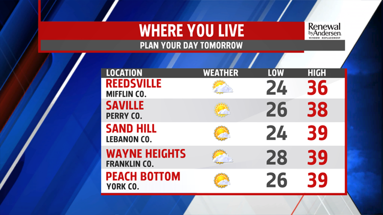


FINISHING THE WEEKEND: We start cold again in the mid-20s Sunday morning. A few morning flurries are possible. Breezes pick up throughout the day with gusts out of the west to 20MPH. Wind chills stay in the upper-20s and low-30s as actual high temperatures reach the mid-to-upper 30s under partly cloudy skies.


BREEZY ALL WEEK: Monday is a near-exact copy of Sunday, though breezes won’t be as gusty. Winds pick up Tuesday and Wednesday with gusts up to 25-30MPH possible. Highs are near 40 but wind chills stay around 30. A powerful cold front comes through Wednesday and will drop highs into the upper-20s, but the breezy winds stay constant at 10-15MPH throughout the week. Temperatures hover around 30 through Friday before slowly warming heading into the weekend.

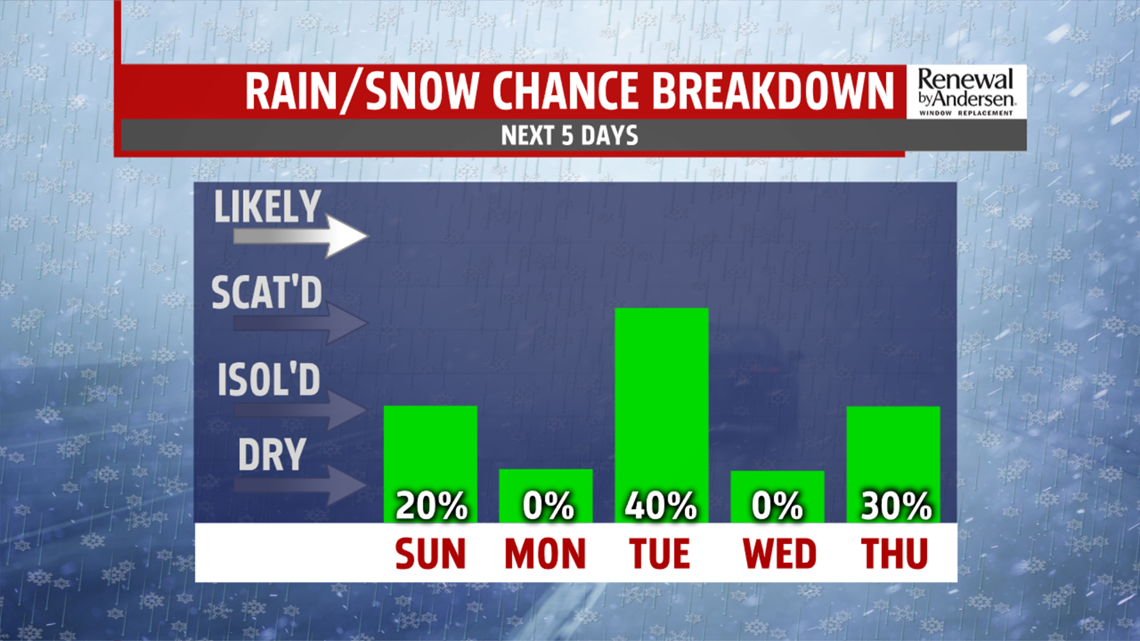
MORE SNOW CHANCES: We see a few flakes Tuesday morning until the late morning. These will be flurries, with minimal accumulation. A few flurries are also possible Thursday night into Friday morning. Skies stay partly-to-mostly cloudy all week long as well.
Have a great rest of your weekend!
-Meteorologist Bradon Long
