

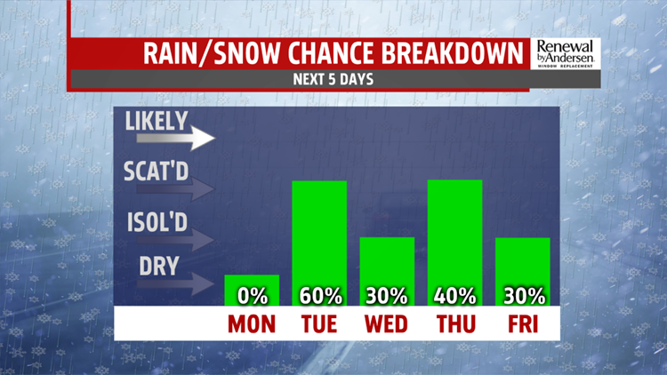

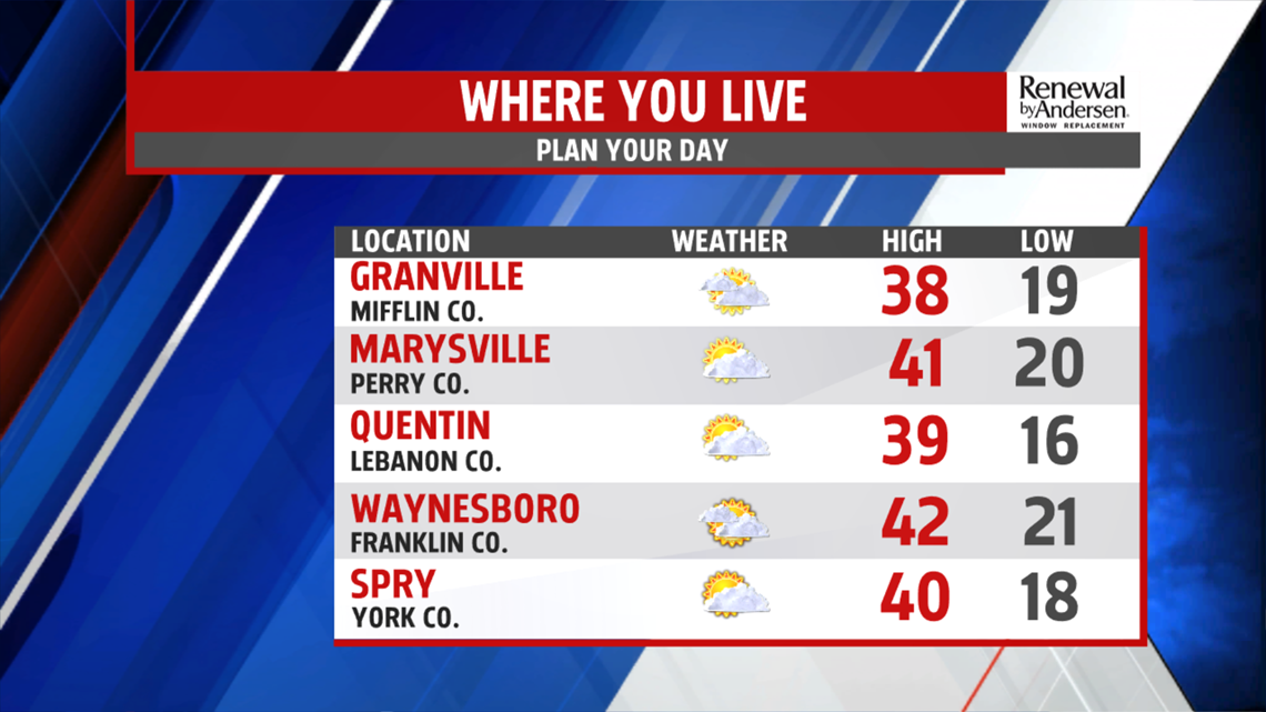

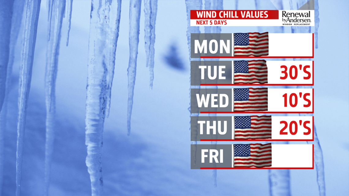
MILDER START TO THE WEEK: The week begins on the quiet side, but you can expect plenty of clouds for the Monday forecast. Temperatures are cold to start, with readings for most in the 20s. A light wind at times makes wind chill values feel a touch lower. Skies are mostly cloudy through the rest of the day, especially the afternoon, as the next wave approaches. Expect afternoon high temperatures in the upper 30s to lower 40s. The overnight period remains cloudy with some snow showers late. Temperatures aren’t as cold, with readings in the upper 20s to lower 30s. Winds pick up Tuesday, and a mix of rain and snow showers are possible throughout the day. A spotty coating is possible in some spots early in the morning. Expect temperatures in the upper 30s to lower 40s. Wind chill values feel like the 30s.


WEEKEND OUTLOOK: The weekend brings a shift in the pattern, making for a milder stretch. Temperatures are near 40 degrees on Saturday under partly sunny skies. Sunday the next system approaches. It increases clouds after some morning sun. A few late day or evening showers are possible. Expect readings in the lower to middle 40s.
Have a great Monday!
