

ARCTIC SHOT!

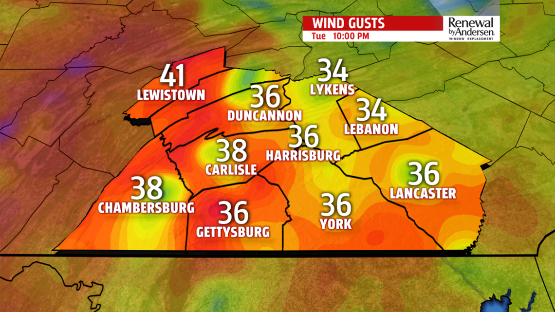
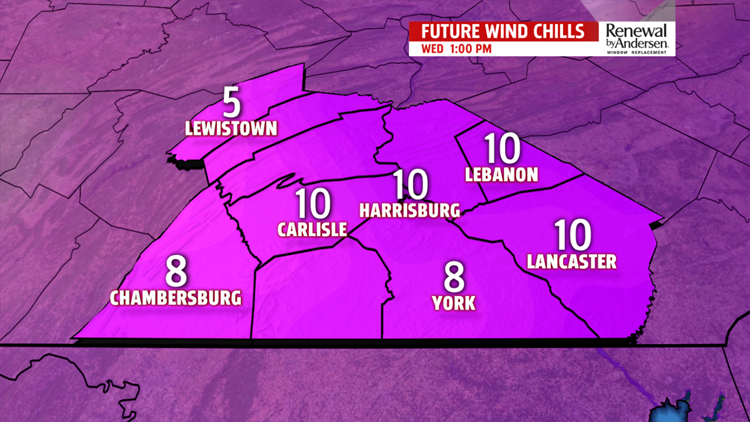
Gusty winds create bitterly cold conditions this evening and much of the day Wednesday. Temperatures, while in the 20s, will only feel like the single digits and low teens so bundle up later today and tonight. The main core of the Arctic air is over us Wednesday. Morning wind chill values are in the single digits, and only recover to the teens later in the day. Strong winds coming across the Great

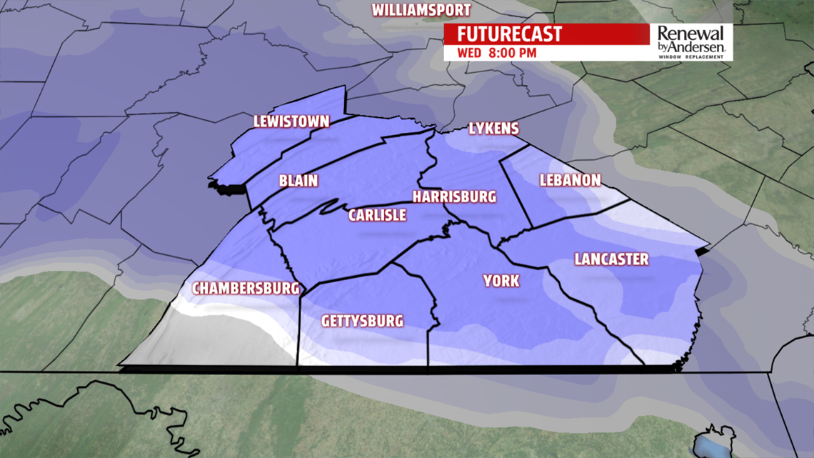
Lakes produce lake effect flurries, and light snow for some spots, especially north and west of Harrisburg. Actual air temperatures stay in the 20s. Another fast moving system approaches Wednesday late evening into early Thursday morning. It brings light snow with some accumulations possible. Accumulations, if any, are minor from a coating to a couple of inches depending on track of the low. Allow for extra travel time for the morning commute, which falls in the time-frame, for the arrival of snow. Breezy north-northwestly winds holds temperatures in the 30s, however, dress for wind chill values in the 20s. A weaker system off the coast Friday may clip us with a few light flurries or light snow showers. We are keeping an eye on the system, which looks to quickly move away from the coast, as it strengthens. Afternoon highs expected in the lower 30s.
WEEKEND WARM UP
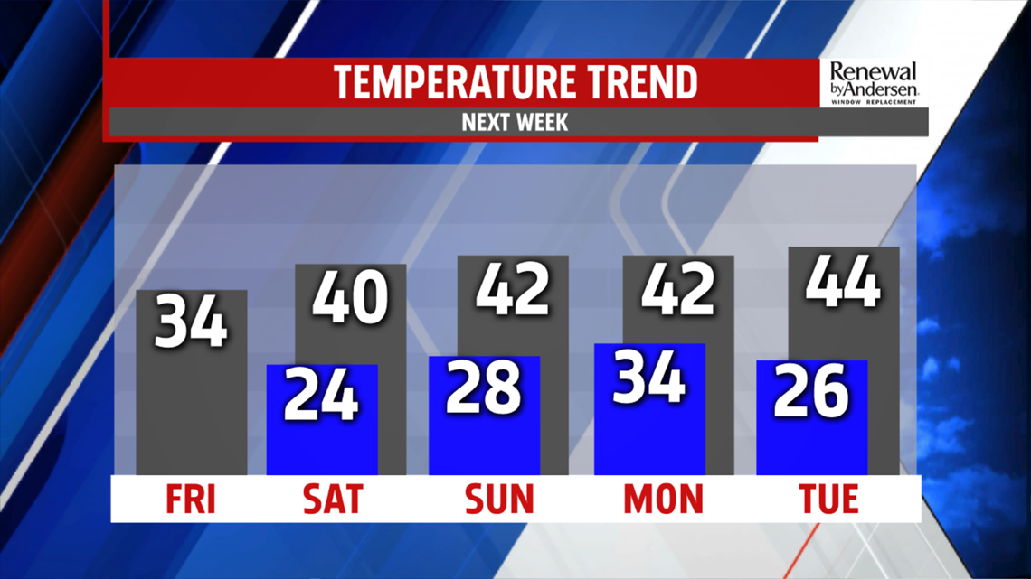
A pattern change into the weekend brings more seasonable air. Partly sunny skies Saturday, and the flow from the west, helps boost temperatures to near 40 degrees. It’s milder Sunday in the upper 30s and lower 40s, despite more clouds. A late day or evening shower can’t be ruled out. As temperatures drop, wet snow may mix in too. There is a greater threat for showers Monday. Readings in the upper 30s and lower 40s keeps the precipitation mainly rain but wet snow flakes are possible in the higher elevations. Tuesday is a drier day, with highs in the upper 30s and lower 40s.

The FOX43 Weather Team is keeping you “Weather Smart” all week long!
Have a good day!
MaryEllen Pann,
Chief Meteorologist
