

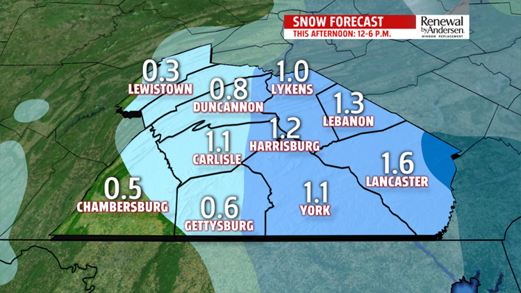
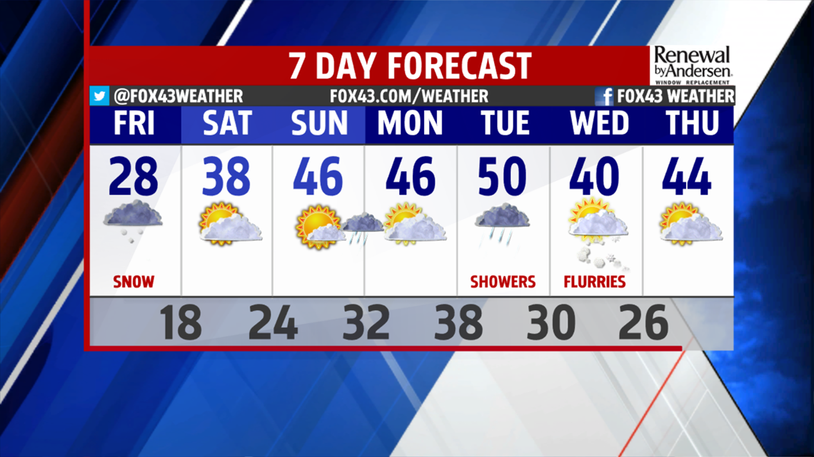
TRACKING SNOW: Today, we'll get a coating to 2" of snow. Most of that falls between 2 and 5 P.M., but fair game for snow anytime between noon and 6 P.M. When the snow will immediately stick as soon as it starts because the ground is so cold. While most places will get a bit more than a dusting to an inch, Lebanon, Lancaster, and York Counties will get over an 1". Lancaster County will get the most snow, with totals over 1.5". Blame a piece of energy that just pops up over PA today for the snow. It strengthens over the most southeastern part of our state, which is why that part of PA gets the most snow, today.
Track the snow with our interactive radar. You can even zoom right into your street. Keep this handy, today.
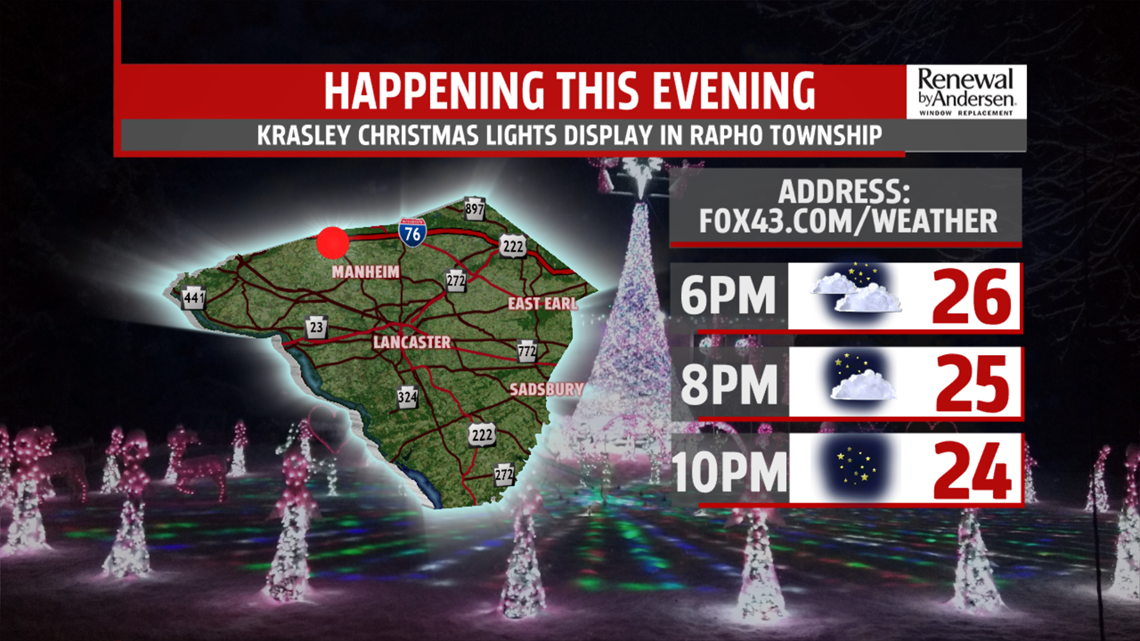
DRIER EVENING: By 6 P.M., the snow will have ended for everyone. So, why not take advantage of it? It's a great night to drive around to check out Christmas lights. Here are some leads: this family's house is in northern Lancaster County by the Renaissance Fair and Christmas Magic in York County, just north of the city. Temperatures will be in the 20s. Then, we head to the upper teens again tonight. If you have a house to recommend, let us know on our FOX43 social media pages. Also, if you're proud of your lights, snap a picture and post it on FOX43's Facebook. I want to show a few pictures tomorrow night on the 10 P.M. news during weather. If you post, let me know the city of the picture.

WEEKEND WEATHER: We'll have partly sunny skies on Saturday and Sunday. Temperatures bump up to 38 on Saturday and 46 on Sunday. Then, Sunday night, overnight, a quick-moving piece of energy brings a few showers. As a result, we'll start out Monday cloudy. Then, the sun comes out Monday afternoon, and we'll grab another high in the mid 40s.


WARMER WEATHER: Temperatures climb to 50 on Tuesday, but we will have some showers off and on throughout the day, particularly in the afternoon. It'll also be breezy.

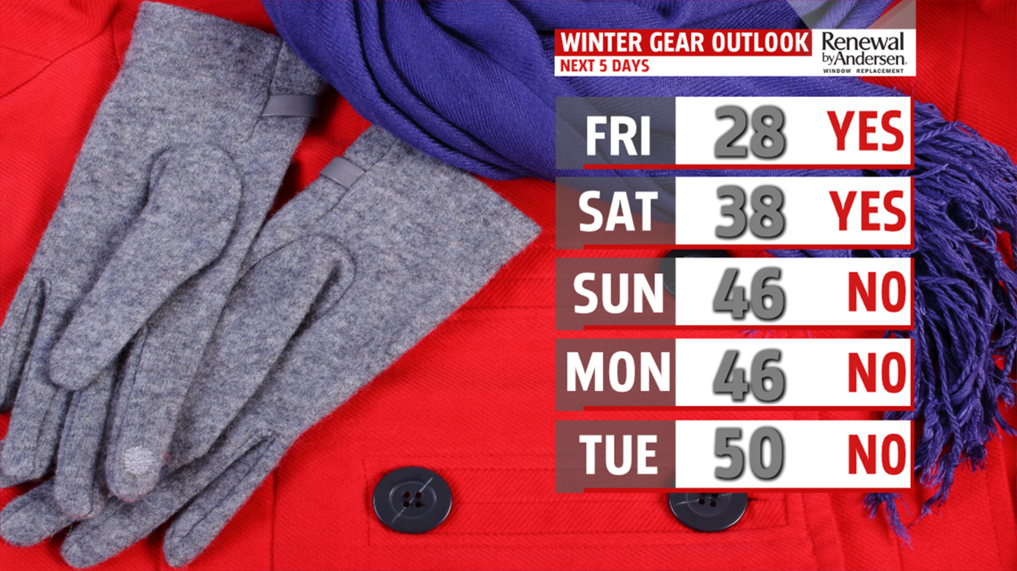
COLDER WEATHER: The cold air marches right back on Wednesday. Not only do we have highs only around 40, but we also have to deal with a bitterly cold wind. The winds will also bring us some lake-effect flurries in the afternoon. We'll loose the wind by Thursday, and get more sun. Look for highs in the mid 40s on Thursday.
WARMING-UP AGAIN: We sneak up to 50 next Friday, but like Tuesday, the price to pay is showers. Except these showers to be steadier and more persistant than the ones we get on Tuesday.

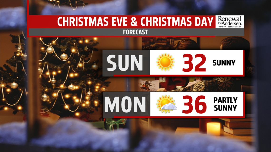
CHRISMTAS FORECAST: Sorry! No White Christmas this year. First of all, we won't have any snow on the ground. Secondly, Christmas Eve is very sunny. It's also cold! Highs will be near 32. As for Christmas, you'll see partly sunny skies and highs in the mid 30s. We have a shot at getting rain on Christmas, but as of now, everything looks dry and the rain comes on Wednesday. However, it's tough to pinpoint this far out. We'll keep you up to date and Weather Smart!

-Meteorologist Drew Anderson
