CHILLIER AIR RETURNS

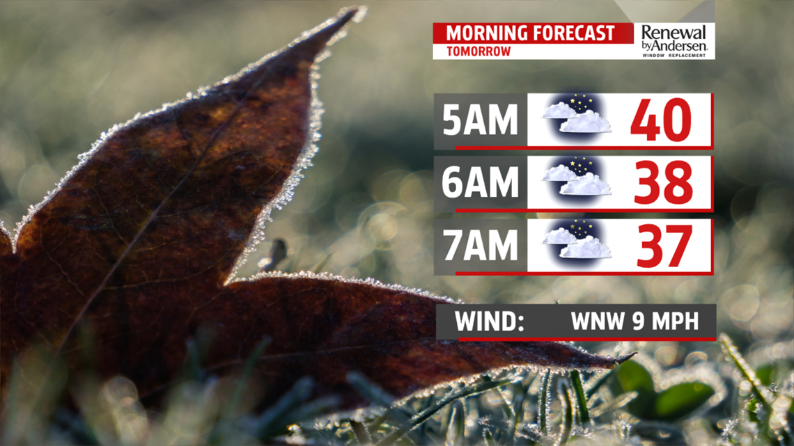
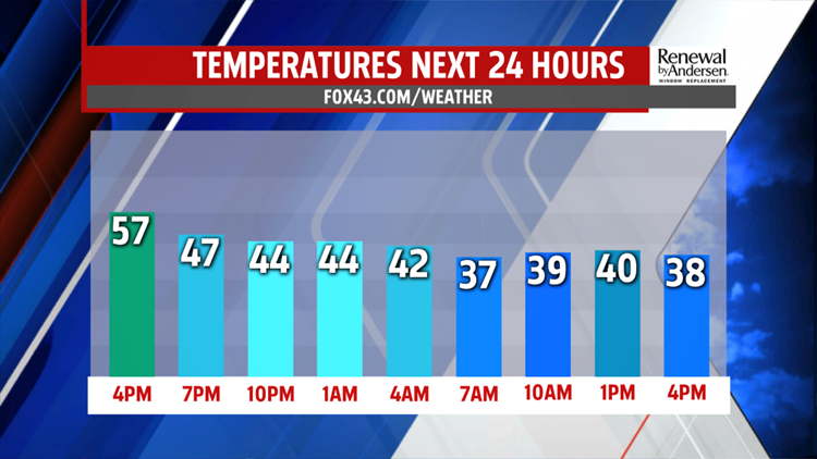
This evening could see a sprinkle or isolated shower. Clouds slowly break up overnight. Temperatures are mild through evening in the 40s, then fall to the 30s by morning. The winds are breezy out of the northwest adding to the chill. Highs fall back to the lower 40s under partly sunny skies. It’s even colder Thursday. Morning lows

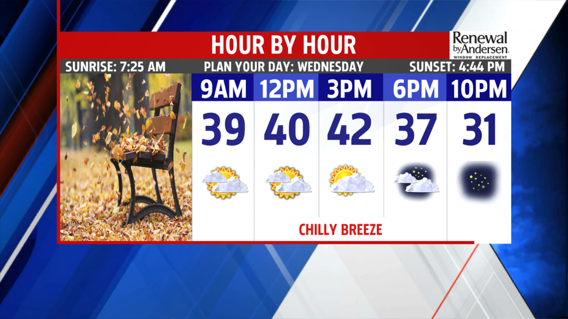
are near normal in the 20s. We climb to the upper 30s to

lower 40s. Skies are a little brighter with more sunshine. Clouds begin to stream back in for Friday. A warm front lifts north allowing milder air to return and also brings a few showers. Readings are back to the middle and upper 40s, and stay there through evening and overnight. Showers continue into the weekend.
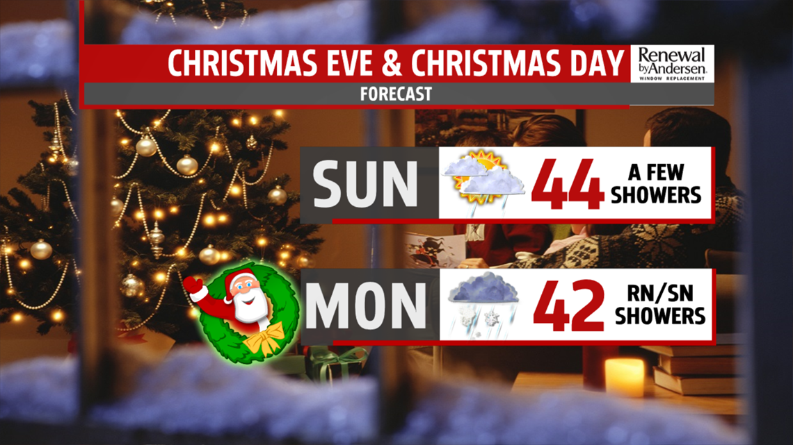
UNSETTLED HOLIDAY WEEKEND
Showers are around for the early part of the day then again during the afternoon when a cold front is tracking through the area. Temperatures soar to the middle 50’s, with a few spots approaching 60 degrees. Once the front is east Saturday night, much chillier air pours in for Christmas Eve. While it’s a drier day, a few showers can’t be ruled out as the next system quickly approaches. As temperatures drop, a transition to a light snow mix is possible. We are watching the system closely for a light accumulation of snow by Christmas morning. Most of the holiday is dry with brisk winds and colder temperatures. Readings fall back even further for Thursday despite more sunshine. Highs are only in the lower 30s.