


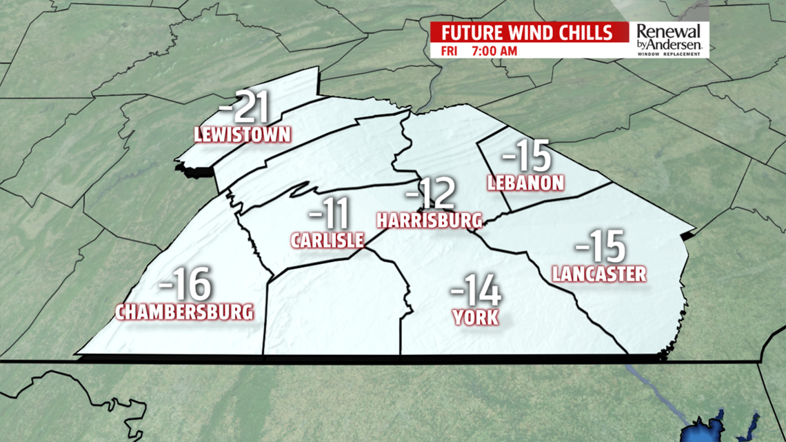

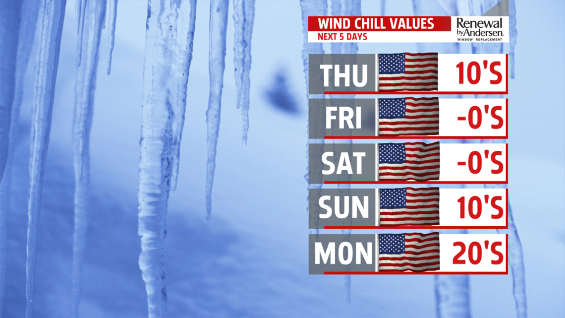
BITTER COLD WEEKEND: Saturday brings more sunshine, but still some breezes. Temperatures are in the teens again after a bitterly cold start near and below 0. Wind chill values are in the single digits during the afternoon. Sunday shows some small moderation in temperatures. Expect readings in the upper teens to lower 20s. Of course, mornings get a brutally cold start too. Morning lows begin in the single digits, and could even dip below 0 for a few spots. Skies turn mostly cloudy during the afternoon after some sunshine to start.
NEXT WEEK: Monday continues a gradual thaw, but the next system approaches fast. Depending on how long it takes to scour out the cold air, there could be a wintry mix to start late Monday before a transition to rain for most through the night. We’ll monitor the wintry mix chances into Tuesday morning. Temperatures do at least manage to jump above the freezing mark during the afternoon on both Monday and Tuesday. Wednesday is partly cloudy and a bit colder. Readings are in the upper 20s to lower 30s.
Have a great Thursday!
