


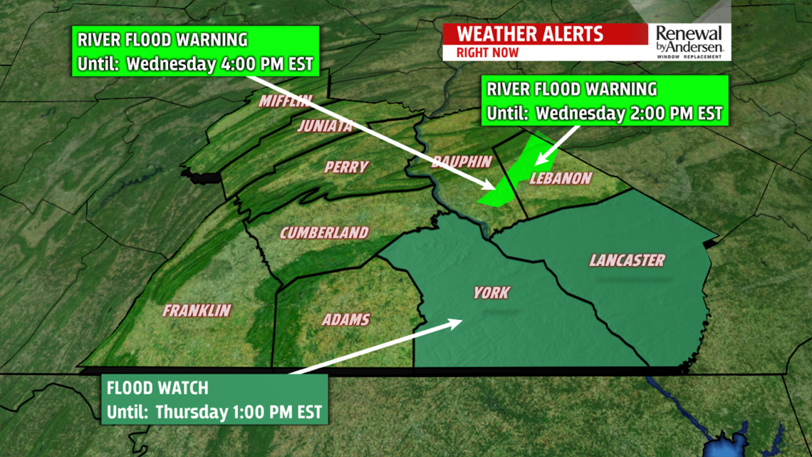
FLOODING: A FLOOD WARNING is in effect for the Swatara Creek at Hershey until 4PM Wednesday. A FLOOD WATCH is in effect for York and Lancaster counties along the Susquehanna south of York Haven due to continued concerns with ice jam flooding. The watch ends at 1:00PM Wednesday.


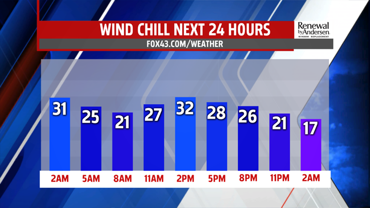
WINDY, CHILLY: Winds today gust toward 30MPH during the morning and 20-25MPH by afternoon. This’ll be enough to keep our wind chills to the low-30s for the afternoon with highs in the low-40s. We see plenty of sunshine and remain dry.

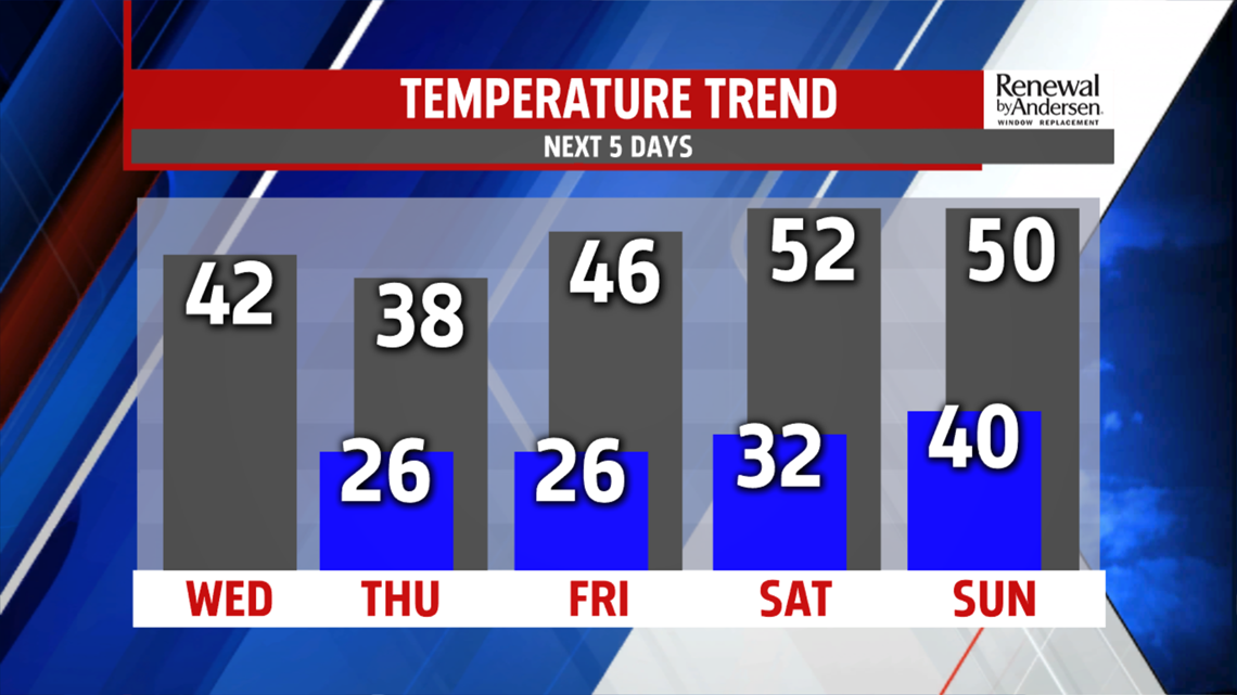
WARMING THIS WEEKEND: Temperatures are coldest Thursday with highs in the upper 30s before warming back into the mid-40s for Friday and the low-50s by Saturday. With this warming comes an increased chance of showers and maybe a rumble of thunder or two late Saturday into Sunday morning. Temperatures drop heading into next week.
Have a great day!
-Meteorologist Bradon Long
