

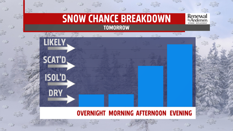

TRACKING SATURDAY SNOW
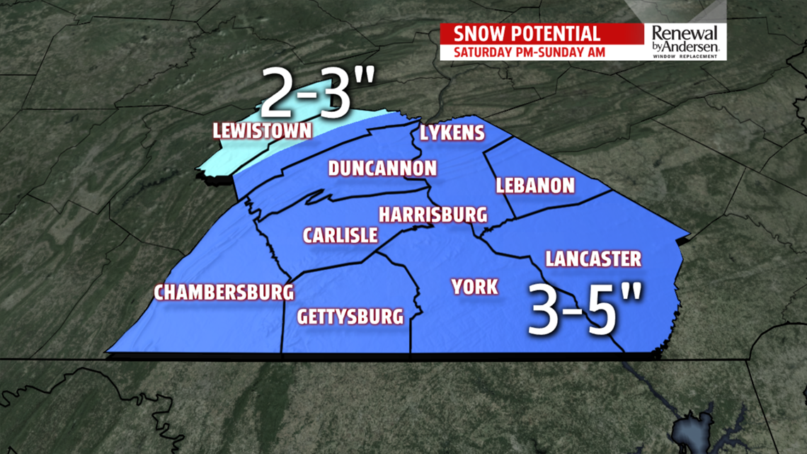
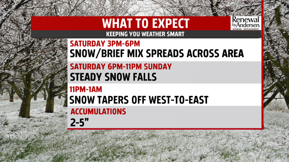
Skies clear this evening and overnight, allowing temperatures to drop into the lower and middle 20s. Winds die down too. Morning sunshine is brief, as clouds quickly race in ahead of our next system Saturday. Temperatures reach the middle 30s. Low pressure tracks by to our south and brings a snow/mix to south-central Pennsylvania. Expect the wintry weather to arrive between 4PM and 7PM. Steady snow falls for several hours before tapering off just after midnight in the west, and 3AM in the east. Depending on track, sleet could continue to mix in to the south and southeast. General totals expected between 2-5”.

Depending on how far north the heaviest snow reaches, lower amounts of 1-3” are possible across our northwest counties. High pressure returns for Sunday, bringing plenty of sunshine back to the area. Afternoon readings are milder in the lower and middle 40s.
NEXT WEEK
Temperatures turn around quickly next week. A warm front lifts through the area Monday. Clouds and showers keep temperatures in the 40s, however, a surge of warmer air follows the front into Tuesday.

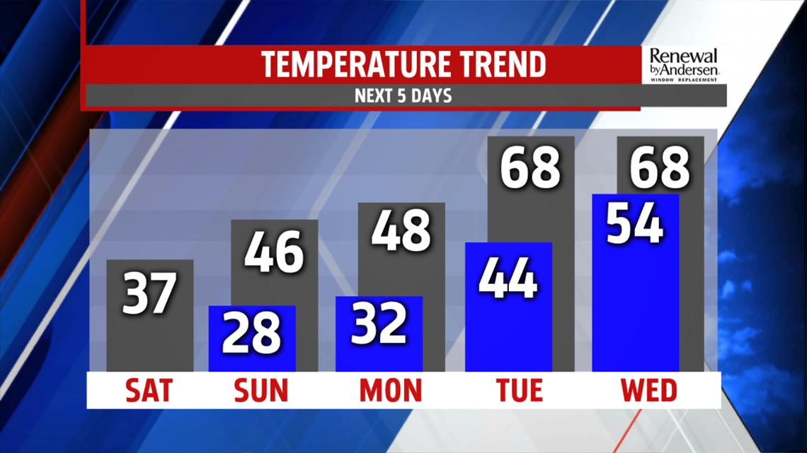
Highs top out in the upper 60s. Several spots even hit the lower 70s. Some differences on timing of the cold front exist on the models. Right now, it looks like the front comes through Wednesday. It is still warm in the 60s. Behind the front it turns cooler again for Thursday. Temperatures fall back to the lower 50s. Wet weather returns Friday with readings in the 40s.
The FOX43 Weather Team is keeping you “Weather Smart” all week long!
Have a good day!
MaryEllen Pann,
Chief Meteorologist
