

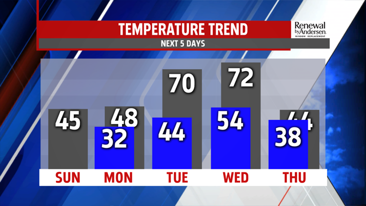


SUNSHINE RETURNS: After the snow ends in the early morning hours, skies clear with a lot of sunshine for most of Sunday. Roads will be slick in the morning, improve by the afternoon, but we’ll have to watch for black ice by Sunday night. Highs reach the mid-40s with significant snow melting. Winds are light.


TEMPS START WARMING: We see the upper-40s Monday and then jump way up, into the low-70s for Tuesday and Wednesday. Skies are partly-to-mostly cloudy throughout the week. The Spring-like feel doesn’t stick around for long, with temperatures returning back to the 40s for the end of the Weather Smart 7-Day Forecast.

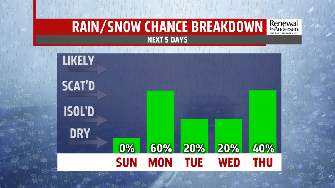
RAIN CHANCES TOO: Rain is likely Monday afternoon with the cooler temperatures. A few sprinkles may hang around Tuesday morning with a very low chance Wednesday evening. As the cold front passes through Thursday morning, off and on rain chances come back, with more rain chances for next Saturday as well.
Have a great one!
-Meteorologist Bradon Long
