
FOX43’s Weather Team has your local forecast here.
The second nor’easter in a span of a week is expected to drop heavy snow and hurl strong winds across parts of the storm-weary East Coast, which had already been pummeled by last weekend’s heavy wind storm.
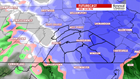
More than 50 million people from Philadelphia to Boston are under winter storm warnings and watches that have been issued across a swath of the Northeast. Nearly 2,000 flights on Wednesday have been canceled.
The storm could bring heavy, wet snow and coastal flooding to the northern mid-Atlantic and the Northeast, which could cause power outages and dangerous commutes Wednesday.
The storm is expected to pack wind gusts of 30 to 50 mph. While it’s a far cry from the 90-mph gusts recorded over the weekend, the strong winds could impede efforts to restore power in the region, where at least 100,851 customers lacked power as of Tuesday, according to area power companies in the mid-Atlantic to New England.
How severe will this storm be?
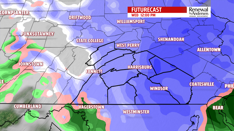
Snow is expected Wednesday morning, with peak precipitation midday into the evening and on Thursday, when gusty winds and snow will mostly impact New England, including the northern Appalachians, said CNN meteorologist Dave Hennen.
It’s not just the snow to be on the watch for. NWS Boston tweeted that “the biggest concern is downed limbs, trees, powerlines w/ 30-60 mph E gusts” and other risks including lowered visibility and hazardous travel.
Interstate 95 is likely to serve as a key dividing line, with areas to its east mainly getting rain and points west due to get as much as 2 feet of snow, Hennen said.
That means places separated by just 15 miles across I-95 could see a huge difference in snowfall totals, CNN meteorologist Judson Jones said. Because it’s going to occur right along the I-95, there’s still some uncertainty over how it might affect densely populated areas on the East Coast.
How will it affect major cities?
The storm will be slightly closer to the coast, which could reduce the amount of snow for big cities due to warmer air coming in from the Atlantic.
New York City could get between 4 and 8 inches of snow. New York City public schools will be open, officials said. The heaviest precipitation will occur Wednesday morning into the evening, according to the National Weather Service New York office.
Philadelphia could also get about 4 to 6 inches of snow, according to the NWS’ snowfall estimates, which advised against unnecessary travel after 7 a.m. City schools will be closed Wednesday, and all after-school activities canceled.
Pennsylvania Gov. Tom Wolf had announced a state of emergency for several counties in preparation for the storm.
Boston will likely see a slushy 1 to 3 inches of snow, which may be more rain than snow. But areas 20 miles inland of Boston are expected to get about 10 or more inches of snow.
How is it affecting travel?
Much of the 1,800 flight cancellations involve major airports in the Northeast, such as Newark, John F. Kennedy, LaGuardia, Boston and Philadelphia, according to FlightAware.
As for ground travel, New York City’s Emergency Management Department issued a hazardous travel advisory urging New Yorkers to “take mass transit if possible and allow for extra travel time.”
Amtrak has also modified some of its services between Washington, D.C. and Boston.
