


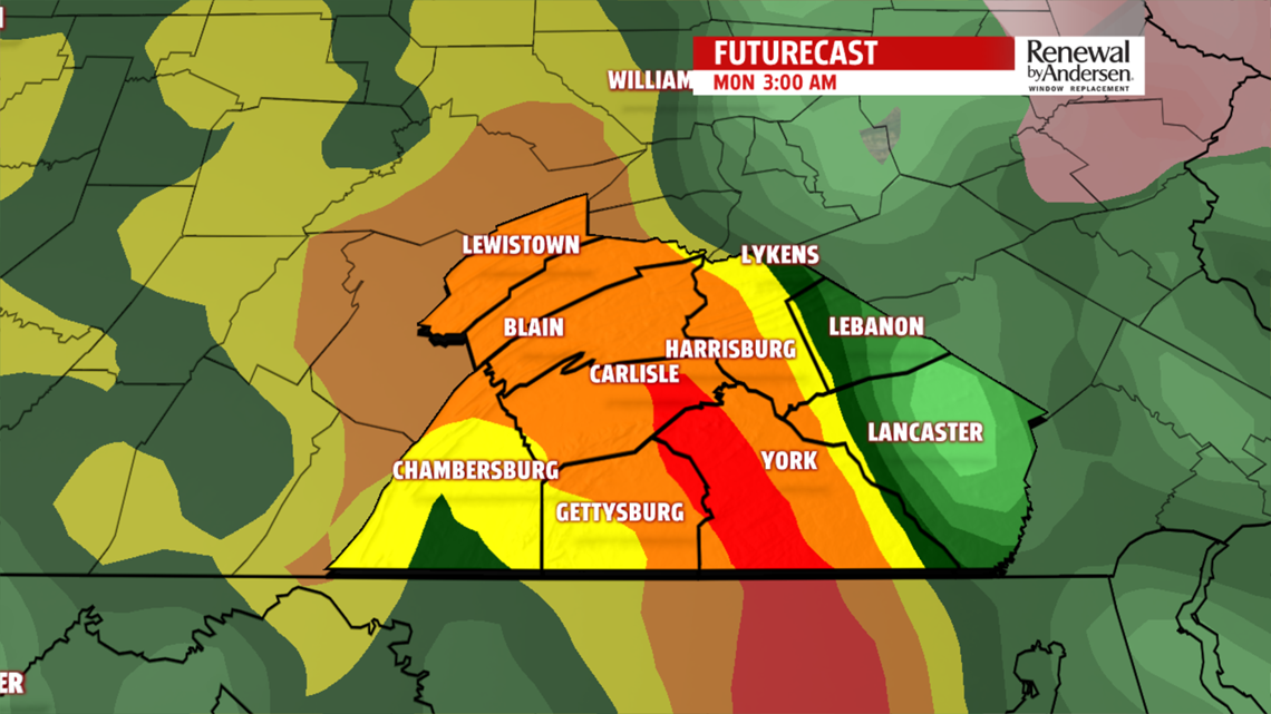
SOGGY START TO THE WEEK: Showers fill in throughout the evening Sunday into Monday morning. As the main line moves through in the very early morning hours of Monday, you may even hear a few rumbles of thunder. Temperatures warm in the morning into the 50s, maybe even a couple locations could push towards 60.
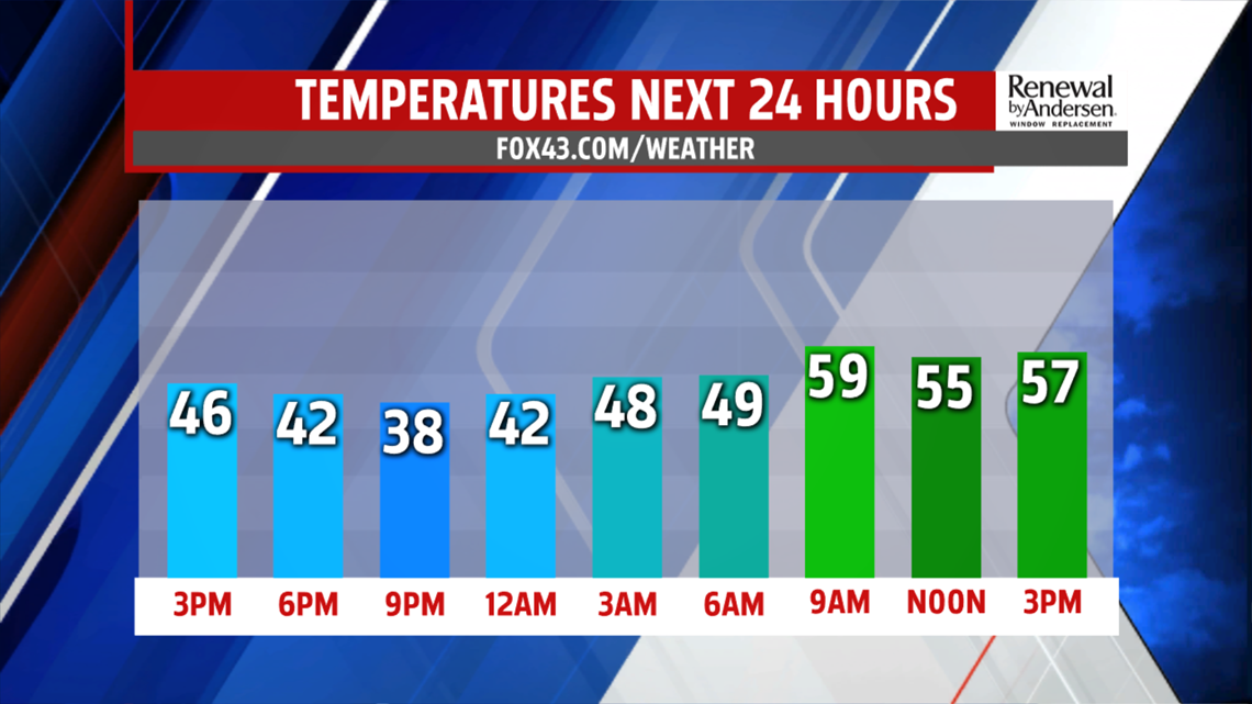
But by the mid-afternoon, temperatures drop once again as the rain stops. Temperatures will settle in the low-to-mid 50s until the sun sets. When all is said and done, a widespread 1-2 inches of rain is likely, with isolated higher amounts possible.

TEMPS DOWN AND UP: Morning lows drop into the 30s for Tuesday, where we can’t rule out a few lake effect flurries. The main story is going to be the breezy conditions all week long. Temperatures don’t make it out of the upper-40s on Tuesday before warming near 60 for Wednesday thanks to a wind shift towards the west-southwest.
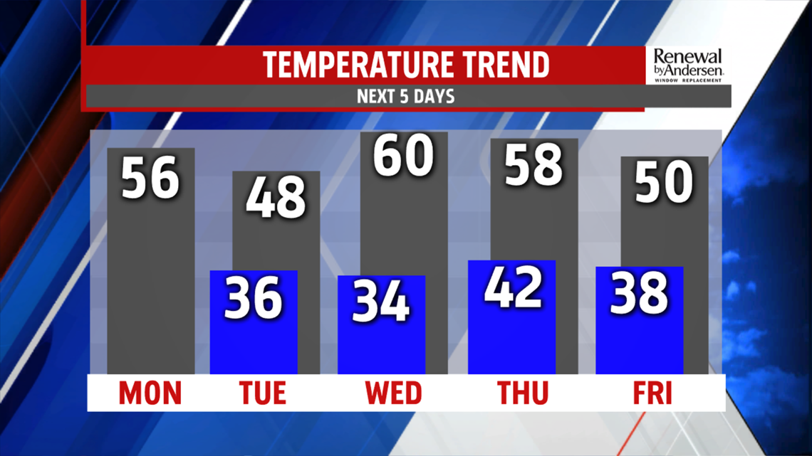
Conditions stay breezy as temperatures stay in the upper-50s Thursday with a chance for showers. As the accompanying cold front pushes through, temperatures drop to around the 50-degree mark once again by next Friday with breezy northwesterly winds.
Stay dry!
-Meteorologist Bradon Long
