


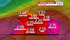

STILL DAMP FOR THE WEEKEND: Conditions remain very unsettled through the weekend, and flood potential lingers too. Expect plenty of showers throughout the day on Saturday. The rain keeps temperatures cool in the 60s. The activity starts to wind down during the evening and the overnight period. By the time all is done, cumulative rainfall amounts since Thursday reach 1 to 3 inches, with the higher amounts likely near the border. Dry time and even a bit of sun moves in for Sunday. Isolated thunderstorms are possible, however. Temperatures are warmer too, in the upper 70s to lower 80s.
NEXT WEEK: The shower and thunderstorm chances linger through early next week. Monday brings the chance for more thunderstorms, with temperatures approaching 80 degrees. Tuesday is more of the same, with the shower and storm chances lingering. Temperatures are near 80 degrees. Wednesday could be the day we finally dry out completely! Temperatures fall back a bit too, with readings in the middle to upper 70s.
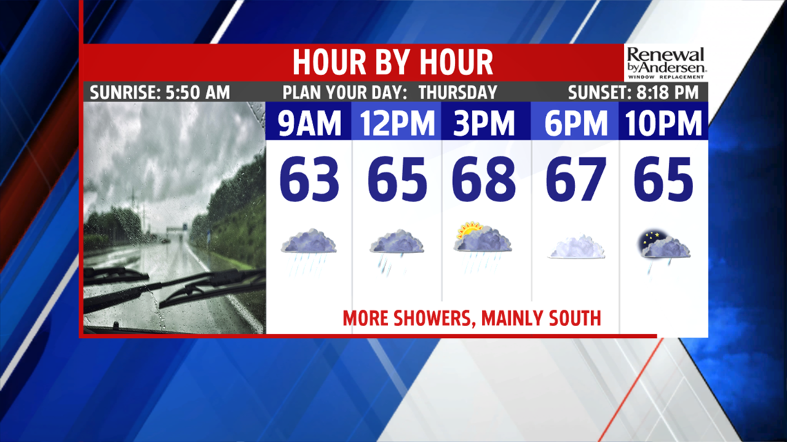
Have a great Thursday!
