Another low pressure system has developed along a stalled boundary to our south and is on the move. It is aiding in spreading rain, sleet and snow across the area this evening. Temperatures are in the mid to upper 30s for much of the Lower Susquehanna but in the higher elevations north and west of the turnpike, they are at or below freezing which is 32 degrees.
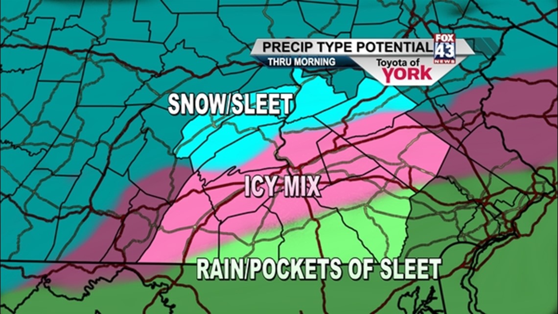
A WINTER WEATHER ADVISORY is in effect until 11am tomorrow morning. Precipitation is falling mostly as rain but as temperatures drop, it will transition to more of a wintry mix including snow to the north and sleet for much of the area. Along the border of MD/PA in York and Lancaster Counties, there is a good chance of most of the precipitation remaining rain with pockets of sleet mixing in. Allow for extra time in the morning. It will be a slow go on area roads.
Temperatures will drop to around freezing by morning. It looks as if the low pressure system pulls off the coast early and the wintry mix comes to an end late morning. Clouds will hang around for much of the afternoon but decrease into the evening. Highs will get to the mid to upper 30s.
Clearing skies tomorrow night will drop temps to the 20s. For Thursday, sunshine with increasing clouds late in the day, will get our temps to the upper 30s before a cold front drops in. It moves out Friday morning allowing, high pressure to build in, giving us a glancing shot at colder air to end the week.
Breezy and chilly for Friday with mostly sunny skies. Looking ahead to Saturday, high pressure will push east allowing the winds to shift meaning back into the 40s for the start of the weekend.
~MaryEllen Pann,
Chief Meteorologist
Facebook: maryellenpannfox43
Twitter: @MaryEllenFox43