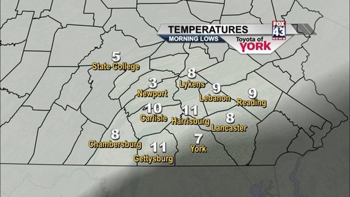
Currently temps are in the teens but headed to the single digits overnight under mostly clear skies. Winds have become lighter than earlier than today but are still breezy. Wind chills presently are below zero!
Expect the freeze to continue for awhile. We start out with sunshine tomorrow but the clouds roll in later in the day as a weak disturbance dives to our south. It may bring a few snow flurries to the area towards evening. Highs will slowly climb to around 20 by afternoon but the winds are still expected to be breezy making it feel like the single digits.
High pressure builds in for Thursday bringing a much calmer and sunny day. It will be quite cold to start but temperatures should rebound by the afternoon into the mid 20s.
The next storm system arrives Friday bringing the chance for snow. Right now it looks like a couple of inches. This storm will be a fast mover and will have limited moisture so at this time, we don’t expect it to be a big deal.
Upper level trof deepens briefly for Saturday keeping colder than average temps around before lifting out in the second half of the weekend. We are back to near 30 Sunday, mid and upper 30s for Monday. There could be rain or snow showers Monday with the passage of a warm front but only about a 30 percent chance of seeing any precipitation. Tuesday we are in the warm sector and could see temps into the lower 40s before a cold front sweeps the area cooling us back into the 30s.
Keep an eye on pets and small children while in the deep freeze.
Have a good night!
~MaryEllen Pann,
Chief Meteorologist
Facebook: maryellenpannfox43
Twitter: @MaryEllenFox43