Here is what we can expect and when. Tonight, a few light snow showers with pockets of sleet mixing in will be likely through morning. A dusting to an inch of accumulations is possible however indications are warmer air pushes in and may change the precipitation to rain at some point wiping out any snow on the ground for some areas especially further to the south closer to the PA-MD line.
Low pressure will strengthen off the NJ coast and pull away tomorrow evening, as it does, we get wrap around moisture meaning the opportunity for snow for a period of several hours which could end up accumulating anywhere from 1” to 3” with isolated higher amounts further to the north and east.
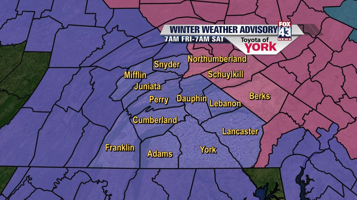
The biggest threat for accumulating snows up to 6 inches will remain in the northern and northeastern part of the state.
From now until 9AM-periods of light snow and sleet mix. Pockets of freezing rain possible towards morning but will depend on surface temps and upper level warming.
9AM until afternoon- possible mix or change to rain for a period of time especially further south. Question will be how far north we see this transition happen.
There is also an indication of some drier air briefly arriving and halting any precipitation for a bit.
Tomorrow Afternoon and Evening-storm strengthens and we start to see a transition back to snow especially in the evening.
Tomorrow night into Saturday-Snow ends but the winds pick up and could gust as high as 30 to 40mph making for a blustery start to the weekend.
Lows tonight in the upper 20s. Tomorrow highs should get to the upper 30s.
Tomorrow night still seeing lows in the mid to upper 20s with highs only mustering the low 30s Saturday afternoon despite sunshine returning.
Sunday starts out very cold under mostly clear skies and calmer conditions. Temps will be able to drop significantly to the mid and upper teens. But a milder flow will help to get us to about 40 degrees.
Milder air for early next week will mean more of a threat for rain showers.
Jeff Jumper, Andrea Michaels are here covering the storm and will keep you posted with details through twitter, facebook and Fox43 WPMT’s website.
MaryEllen Pann, Chief Meteorologist
Like me on Facebook: maryellenpannfox43