
COLD DAY: Sunshine will be eaten up by thickening clouds today ahead of our next weather maker pegged for Friday. Expect mainly cloudy skies with temperatures held in the middle 30s for highs today. Winds are relatively light out of the southeast. We’re dry through the day.
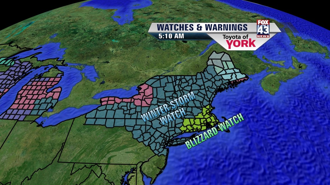
NOR’EASTER: Lots of talk about this Nor’easter and it will be a big deal for those in New England. As far as the Midstate, it looks to be a messy forecast, but for different reasons. Right now, we’re not expecting any major accumulations of snow, sleet, or ice, but what falls and what happens at any given hour will be the tricky part. Let’s break things down as to what we know right now.

We begin this evening with the chance for widely scattered light snow showers moving in after sunset. Right now, it looks like not everyone will see these. Then isolated snow is possible through the early overnight hours.
Shortly before dawn, we’ll see some warming in the low levels. This will change any snow over to sleet or freezing rain for the morning commute into mid-morning. Again, we’re not expecting much accumulation here as temps will be close to or above freezing.
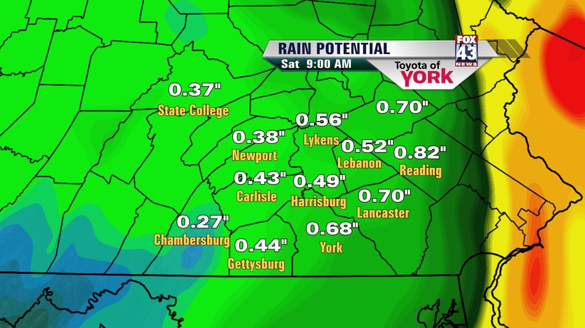
The freezing rain/sleet should changeover to mostly rain, but sleet and freezing rain can mix in for the colder locations throughout the day. Highs are expected to be warmest to the south and east near 40°. The best chance for accumulating rain will be in the afternoon hours Friday.
Then, the evening hours will feature tapering precip as temperatures drop and winds pick up. We could see the rain end as some isolated snow showers into the overnight hours.
We are on the edge of an icy forecast, so keep checking back tonight and through tomorrow for any changes, which are likely. Some places in New England may see 18-24”+ of snow out of this.

WEEKEND: It’s cold and windy Saturday but sunshine returns. Highs are in the low 30s with strong northwesterly winds. Sunday is a sunny day with temps nearing 40°.
NEXT WEEK: It looks like a system will bring us rain Monday and clear us out for Tuesday. Wednesday, the models are in vast disagreement. We’re holding partly cloudy skies and the chance for some rain/snow mix for now. We should be in the 40s for the early part of the week.
Have a great Thursday.
– Jeff Jumper, Fox43 Morning Meteorologist
Follow me on Twitter: @JeffJumperWX
Like me on Facebook: Jeff Jumper Fox43