
ANOTHER COLD DAY: High pressure will build in from the north today, working to scour out the early cloud cover and return the Midstate to sunshine! The cold northwesterly breeze stays with us today. So temps will climb to the middle 30s, but wind chills stay in the low to mid 20s. Bundle up. We gradually increase the cloud cover overnight as temps fall to near 20°.
FRIDAY-SATURDAY SYSTEM: A messy weather maker is giving the middle part of our country a run for their money today with a mess of snow, sleet and freezing rain. The energy from this system will split as it shifts east and moves toward Pennsylvania, leaving behind a much weaker system. Friday, we expect some moisture to give us clouds first. Then, the chance for some light snow/sleet is possible as moisture increases and glides in form the south. The models paint a very light and sporadic precipitation shield for Friday as energy passes to our northwest. We don’t expect much out of this. As temps climb to the mid an upper 30s, some of this may mix to rain.

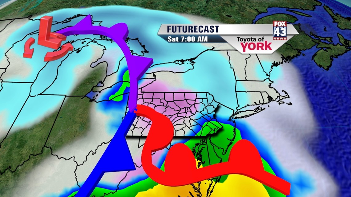
Then, energy to our south will glide northeastward into Virginia, developing a coastal low by late Saturday. The northern edge of this deepening system will grace our region with precipitation on Saturday. We may begin the morning with a wintry mix, but warmer air surges in and turns it to rain by Saturday midday. This will continue as rain through the afternoon and evening hours. As the system pulls away Saturday night, a few flakes may fly on the back side. Highs Saturday will be in the low 40s.
INTO NEXT WEEK: Sunday looks mild as the system pulls off the coast. We expect gradual clearing with temps in the mid 40s. Monday looks mainly sunny with slightly warmer weather. By Tuesday, our next system arrives. Models are in disagreement with timing and cold air interaction. For now, we are sticking with the rain scenario with temps in the mid 40s. It all tapers as a mix to snow on Wednesday, with temps near 40°.
Happy Friday Eve! Enjoy the day!
– Jeff Jumper, Fox43 Morning Meteorologist
Follow me on Twitter: @JeffJumperWX
Like me on Facebook: Jeff Jumper Fox43