
WINTER IS STILL HERE
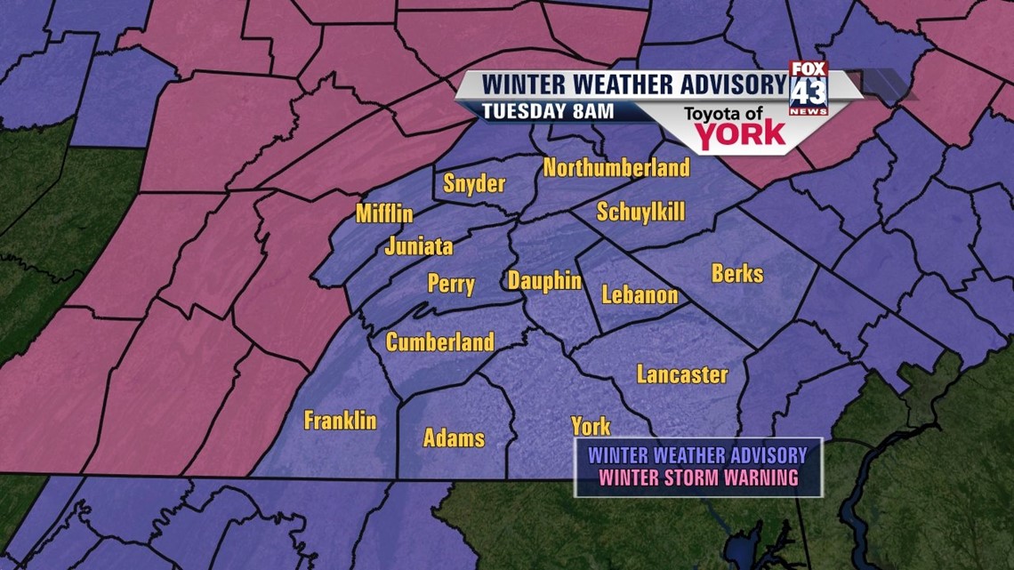
A complex storm system and associated cold front is tracking in from the west. Snow stopped earlier now just seeing light rain and drizzle with pockets of freezing drizzle. Fog is also forming across the Lower Susquehanna Valley. Because of the snow on the ground and roadways and temperatures still hovering around freezing, there is likely to be slick spots on roads and surfaces. WINTER WEATHER ADVISORY remains in effect for the area until Tuesday morning. This means traveling may be a bit dangerous because of slippery roads and limited visibilities.

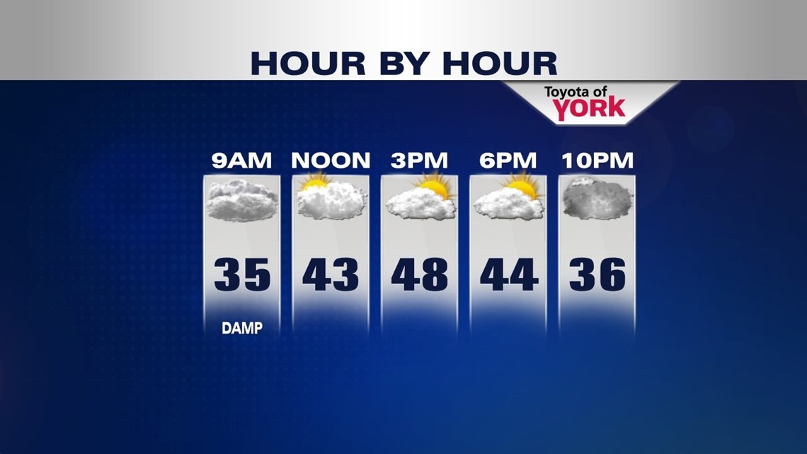
Most of the precipitation will change over to light drizzle after midnight as temps warm up.
WARMEST DAY OF THE WEEK
Tomorrow will actually see the moisture move out. May get a little sunshine by afternoon and that will give us the warmest temps of the week before colder air returns Wednesday and Thursday. Some areas south may reach the low 50s.

THE CHILL IS BACK
Upper level trough sets up over the area Wednesday and Thursday reinforcing colder air. Morning lows will drop into the 20s, while highs will get into the low 40s for the official start of spring, Thursday will struggle to see temps warm through the 30s. There could be a few flurries on Thursday but does not look to be a big deal.
QUIET WEEKEND
Sunshine and a bit warmer for the upcoming weekend but still temperatures will be running below average. So even though spring arrives Wednesday, it won’t feel like it.
MaryEllen Pann, Chief Meteorologist
Like me on Facebook: maryellenpannfox43
Follow me on Twitter: @MaryEllenFox43