
After a gloomy foggy start, sunshine ends our day. Temperatures have warmed into the low 50s but colder air will be returning as we head into the first day of spring.

A BIT CHILLIER

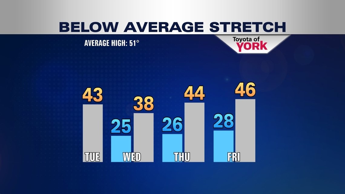
It will be a bright but cold start to tomorrow then the clouds will develop in the afternoon mixing with the sunshine. Highs will be chillier than today reaching only into the low to mid 40s. The breeze will kick up again out of the west 10 to 20 mph.
Thursday will be coldest day of the week. Highs will struggle to get through the 30s. There may be a few flying flakes in the area and once again it will be a bit breezy making it feel even colder.
REBOUNDING FOR FRIDAY
The upper low will start to lift out allowing for a break from the chill. Temperatures should get into the mid 40s under mostly sunny skies.
WEEKEND IMPROVEMENT
More sunshine and milder temperatures for Saturday, so if you have plans to run around, it should be dry with highs in the mid to upper 40s.
Second half of the weekend starts out with sunshine and with a flow out of the southwest temperatures should flirt with 50 degrees. Clouds will be on the increase as the next storm system arrives from the west.
ARRIVAL OF NEXT STORM

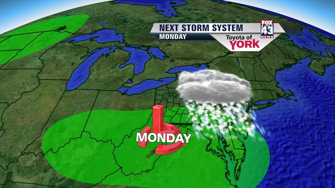
The next best chance for precipitation may arrive late Sunday night into Monday morning. Current models are having a difficult time on where the low tracks exactly. Rain or snow showers will be likely Monday and although it will be spring, temperatures look to remain below normal into next week.
MaryEllen Pann, Chief Meteorologist
Like me on Facebook: maryellenpannfox43
Follow me on Twitter: @MaryEllenFox43