
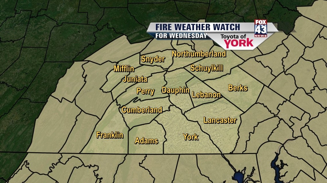
FIRE WEATHER WATCH in effect for Wednesday due to low relative humidity as low as 21 percent, gusty northwest winds 10 to 20mph with gusts to 30mph and temps in the 40s. The potential exists for rapid spread if uncontrolled fires develop or for prescribed burns get out of control. Outdoor burning not recommended.

It was a chilly day with highs only in the low 40s but feeling like the 30s thanks to the gusty winds. The clouds that developed this afternoon will clear tonight leading to another chilly night in the 20s. Winds will ease up after midnight to around 5 to 15 mph.
ONE MORE DAY IN THE 40s
An upper level trough will still be in place along with gusty northwesterly winds. That means another day with temperatures in the 40s. Plenty of sunshine to start the day but clouds will bubble up in the afternoon before clearing tomorrow night. Winds will start to relax towards evening as the trough lifts and high pressure builds in and calms things down. Lows will be cold in the 20s Thursday morning.

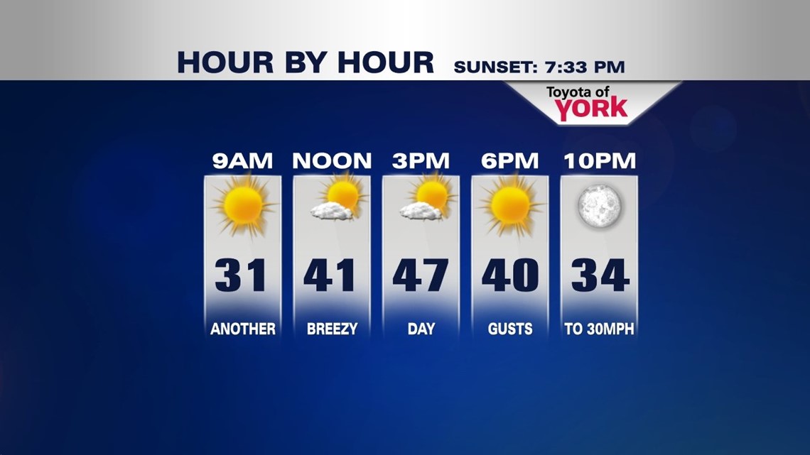
Wednesday will be a beautiful day with plenty of sunshine but again temperatures will be running below average and stuck in the 40s. Winds may start out breezy but as high pressure builds in they will calm rather quickly by early evening.
NICE CALM THURSDAY
Trough flattens a bit and high pressure builds in at the surface allowing for plenty of bright sunshine and a calmer day across the Lower Susquehanna Thursday but a southern system will bring in some high clouds mid-day. Highs will top out in the mid 50s.
STILL COULD SEE A GRAY FRIDAY
Models are not in agreement on a southern system bringing showers for Friday. We’ll stay consistent the majority and keep the threat for a few showers especially early to mid afternoon. Highs will be held to around 50 with the overcast skies and possible wet weather.
NICE WARMUP FOR THE WEEKEND!
Hopefully, we can finally enjoy a nicer weather pattern going into next weekend and the second week of April. Saturday we’ll see plenty of sunshine with highs in the mid 50s. The flow will switch and we’ll tap into finally some much more seasonal like temperatures. Temperatures should be flirting with 60s and we may finally get there Sunday. Highs look to get into the low 60s under increasing clouds. There are some indications that a frontal system may bringing a few showers in late Sunday then stall across the area Monday keeping the wet weather threat around. But temperatures look to hit 60 again Monday. A few showers will be possible Tuesday as a series of fronts oscillate through the area.
MaryEllen Pann, Chief Meteorologist
Like me on Facebook: maryellenpannfox43
Follow me on Twitter: @MaryEllenFox43