
Morning clouds cleared right on cue today bringing a fabulous afternoon with plenty of clear skies and sunshine. Winds picked up out of the northwest and are a bit breezy but they will relax later tonight. Highs soared into the low 60s finally warming above average!
CLEAR, CALMER & COLD
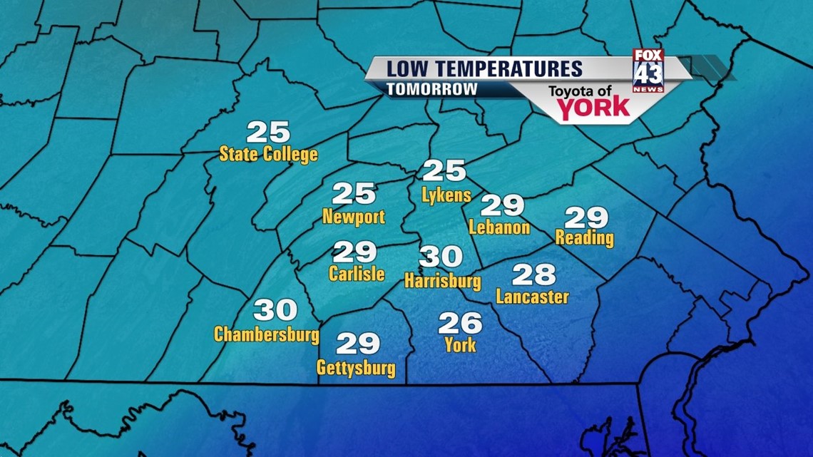
High pressure builds in keeping our skies clear, calming our winds and allowing temperatures to get cold. They will drop into the upper 20s to low 30s.

SATURDAY SUNSHINE
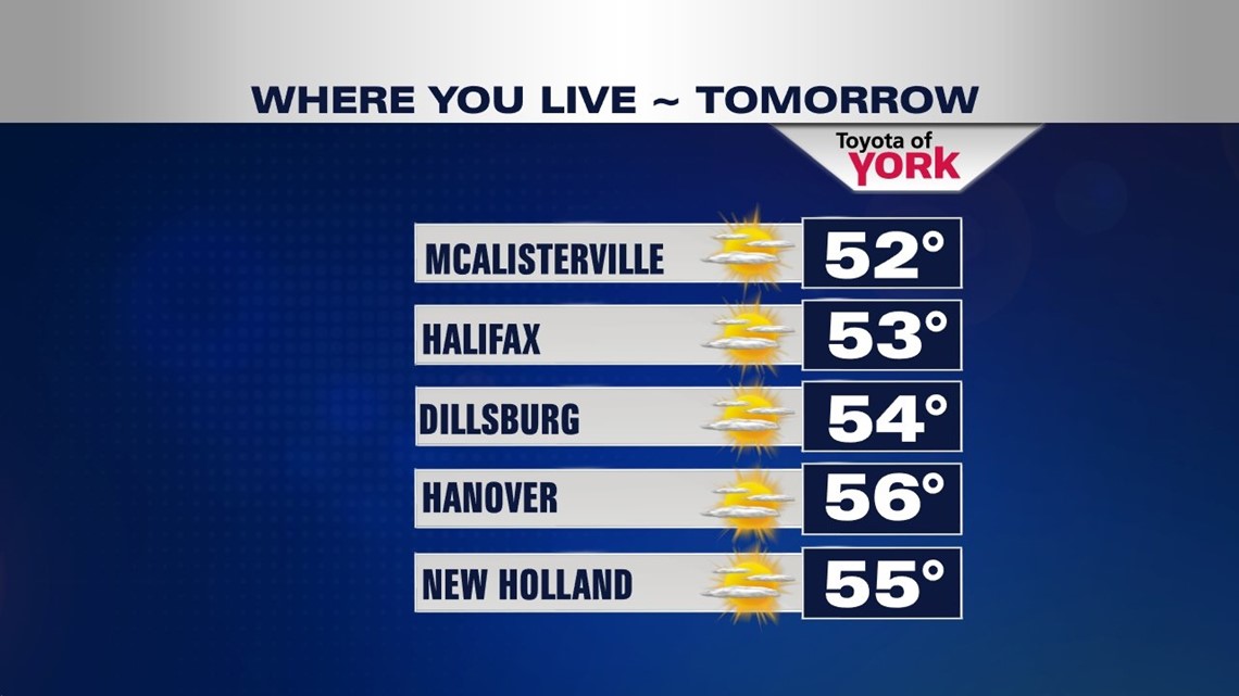
Plenty of sunshine to start off the weekend but as the high slips to our east and a warm front approaches from the west, we’ll see high clouds streaming in through the day. Still plenty of sunshine but temperatures will be cooler in the low to mid 50s.

TURNING WARMER
Even though there will be more clouds in place for Sunday, temperatures will get into the low 60s. A series of fronts will oscillate back and forth for several days keeping a threat for showers in each day. Isolated thunderstorms are possible especially Thursday and Friday. Temperatures will warm into the upper 60s Tuesday and near 70 degrees by Wednesday. With showers and storms and a cold front crossing the area, temps will reach the mid to upper 60s on Thursday then fall back to the low 60s by the end of the week.
With April showers come May flowers, and hopefully an end to blustery cooler than average temperatures.
MaryEllen Pann, Chief Meteorologist
Like me on Facebook: maryellenpannfox43
Follow me on Twitter: @MaryEllenFox43