
WARM STRETCH ENDS: After nearly breaking a record high for the second day in a row, we’re done with the 80s for a while as more seasonal air begins to shift into the state. Today will be a tough day on the temperature forecast. A stationary front is draped over our area. This means some spots to the north and east will only muster up low and middle 60s for highs while to the south and west we may see middle 70s. It’s mostly cloudy today with some fog in spots early. Expect isolated showers during the day, but the main event will be tonight.
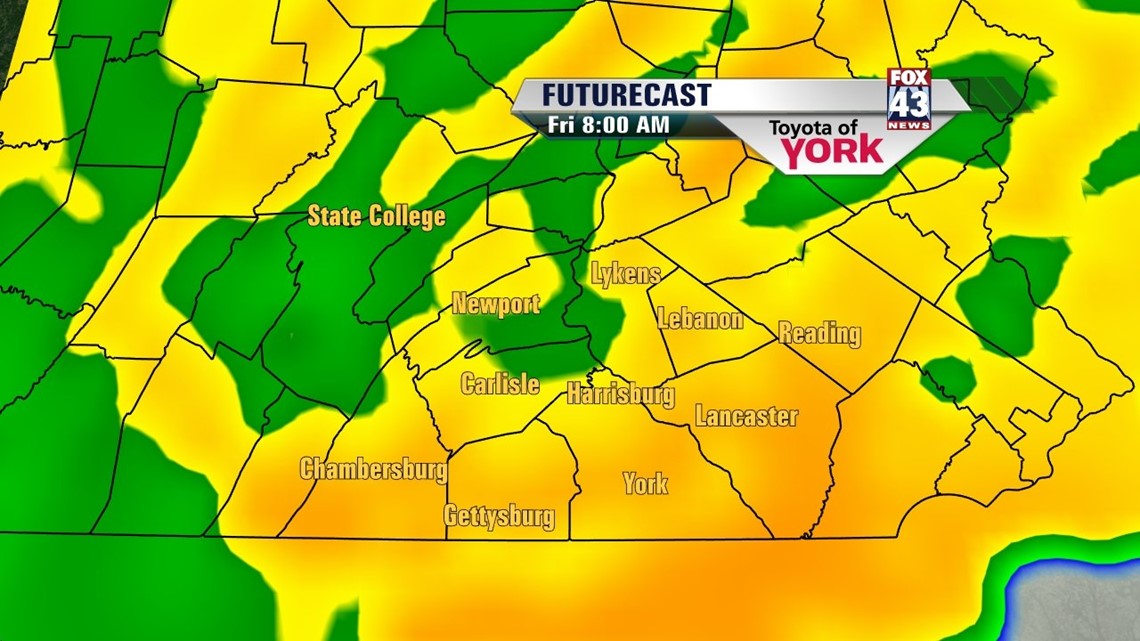
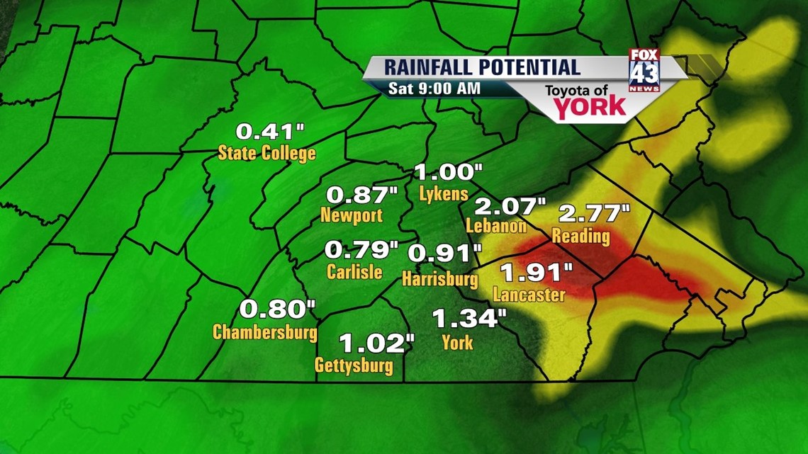
WEEK ENDS WET: A strong cold front and associated low will move through the state tomorrow. Ahead of the system, we’re expecting a good dose of rain beginning during the late overnight hours. Rain will be heavy at times during the morning commute on Friday with a few embedded thunderstorms possible as well. The rain tapers to showers by afternoon, with gradual clearing later in the day. Expect a good soaking of 0.75”-1.25” once it all wraps up. Highs Friday will be in the mild middle 60s.


WEEKEND: Saturday, a wave moves aloft which means we’ll see clouds mixing in with the sun. A cool breeze will kick in too as temperatures only make it to the upper 50s for highs. The cool pocket of air settles in for the night as temps fall to the upper 30s. On Sunday we’re about the same temperature wise with more sunshine added to the mix as high pressure slips by. This is more on target climate wise for April.
WEEK AHEAD: We’re warming yet again by Monday. Several weak disturbances will race to our north. We may get clipped with isolated showers or storms Monday and scattered storms for Tuesday and Wednesday. Highs will make it back into the 70s for mid-week. Another system looks to bring us a batch of rain and storms as we close out the week. We’ll be watching.
Enjoy your Thursday. We’re almost to the weekend!
– Jeff Jumper, Fox43 Morning Meteorologist
Follow me on Twitter: @JeffJumperWX
Like me on Facebook: Jeff Jumper Fox43