
WARM & WET: Today is the last day of warm weather for a little while, and it ends with a wet evening. We’ll be near seasonal averages if not just below as we head through the next several days.
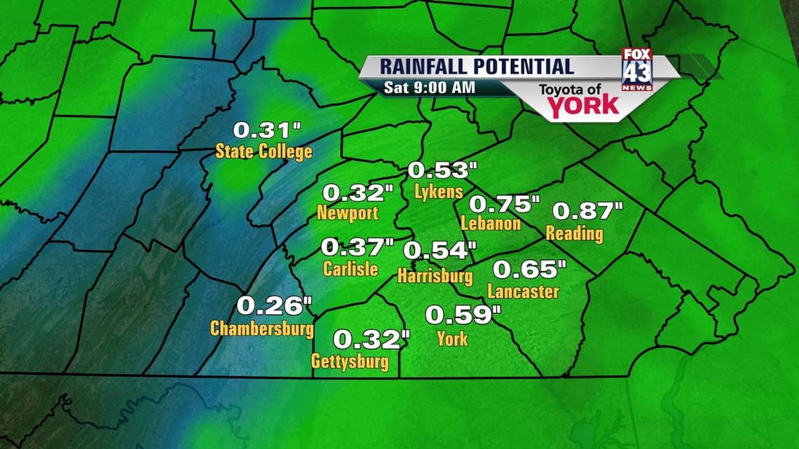
Expect a relatively mild start to the morning with low clouds and some foggy spots. The breeze should limit much of the fog to start. We’ll see some sunshine through the morning and midday, but clouds will generally be the rule. Expect highs to climb into the low to middle 70s with a stiff breeze out of the southeast. Then a front pushes through the state, forcing a line of showers and thunderstorms to move eastbound. Expect the rain to begin around 3-4 P.M. in the west, spreading eastbound during the evening commute. Rain, will be heavy at times and winds could be a little gusty, especially in any thunderstorms. Rain will be heaviest later in the evening. The severe weather threat is looking very low at this time. The rain tapers from west to east in the early overnight hours. We’ll see about a 0.50” out of this when it’s all done (some higher/some lower due to downpours).

The cooler air slips in overnight on the heels of westerly winds. We’re cloudy too. Expect lows into the 40s.
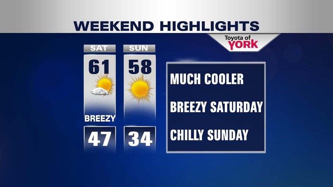
COOL WEEKEND: Saturday will be breezy with skies clearing through the morning. Sunshine will work against a cool westerly breeze. Highs should hit the low 60s for many. Sunday will be less windy with more sunshine. The coolest air will settle in with high pressure moving nearby. Expect upper 50s for highs after a start in the low 30s!

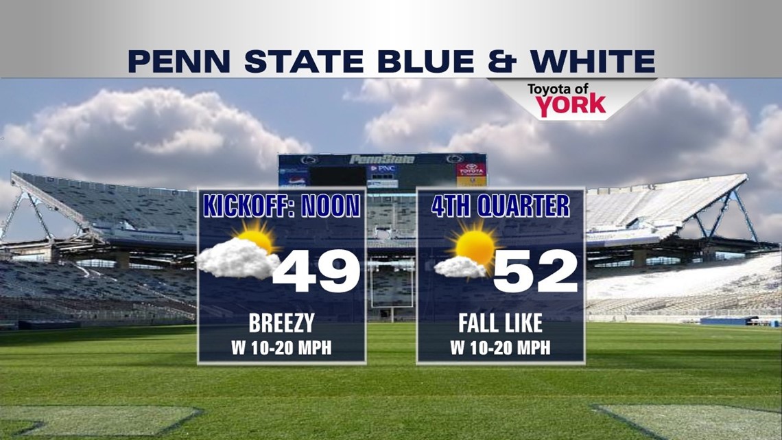
If you’re doing Blue and White in State College this weekend, dress warmly. We begin tailgating mostly cloudy with temps in the 40s. It’s breezy too. By game time, we’re only in the upper 40s and low 50s but sun should make a good return. Enjoy the game!

NEXT WEEK: We stay a bit cool next week as we watch some most flow off the Atlantic prevent a big temp rise. Monday and Tuesday are partly to mostly cloudy. Highs Monday hit the low 60s and Tuesday will be in the mid 60s. A front moves through bringing rain and some rumbles on Wednesday with highs in the mid 60s. We cool and clear again to close out the week, back into the low 60s.
Have a fantastic Friday and a safe weekend!
“Happiness is not a state to arrive at, but a manner of traveling.” –Margaret Lee Runbeck
– Jeff Jumper, Fox43 Morning Meteorologist
Follow me on Twitter: @JeffJumperWX
Like me on Facebook: Jeff Jumper Fox43