
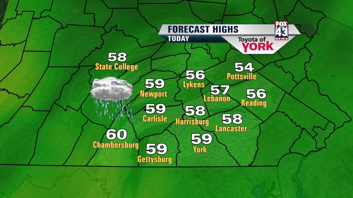
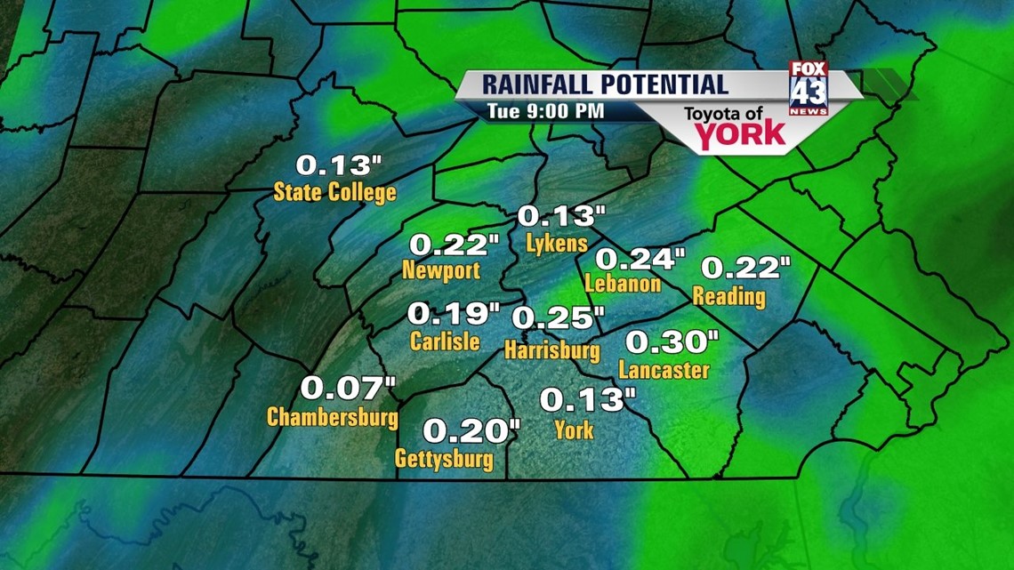
WET START: A blocked up pattern aloft and broad wave of low pressure with some energy aloft will keep our weather unsettled, damp, and cool over the next few days. High pressure sits to the northeast which keeps flow from the east, pushing in the moisture needed for clouds and showers. Expect a cool, cloudy, and showery Monday with highs relegated to the middle and upper 50s for most. Some to the far west may tap into the low 60s. The showers will be light for the most part and scattered through the day. Better chances look to exist during the afternoon and evening. Overnight, we only fall into the low 50s with damp and drizzly, foggy conditions.

Tuesday, we’ll see some sun poking through as temps rise into the low 60s. A few showers will be roaming around during the daylight hours as well. The east/southeast winds will continue. Finally by Wednesday, with the exception of an isolated sprinkle, the pattern begins to break a bit. Highs are back closer to seasonal average – in the upper 60s. A little more sun makes it through.

CLOSING OUT THE WEEK: We expect the clouds to slowly subside for Thursday and by Friday and we should see more sunshine. This all depends on the position of high pressure to our north and how much easterly flow we see. The right positioning of the winds can promote cooler air backing up against the mountains and cloud cover. For now we expect that to break on Thursday. Highs should top out in the upper 60s to near 70° to close out the week with dry conditions. Mornings will be seasonably cool and in the mid to upper 40s.
WEEKEND: The flow remains blocked but we’ll jockey around some high and low pressure positions. A cut off low will form and float around just to our south and west as high pressure slips southward over the state. Expect more sunshine for the weekend and temperatures in the upper 60s with dry weather prevailing both days. Although models are in good agreement, upper-level lows can be tricky to forecast and any shift in the position could shift our forecast to cloudy, shower, cool weather. Stay tuned!
“Men’s best successes come after their disappointments.” –Henry Ward Beecher
– Jeff Jumper, Fox43 Morning Meteorologist
Follow me on Twitter: @JeffJumperWX
Like me on Facebook: Jeff Jumper Fox43