

CHILLY START TO THE WEEK

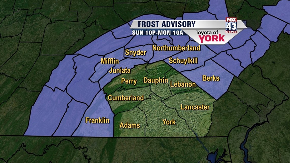
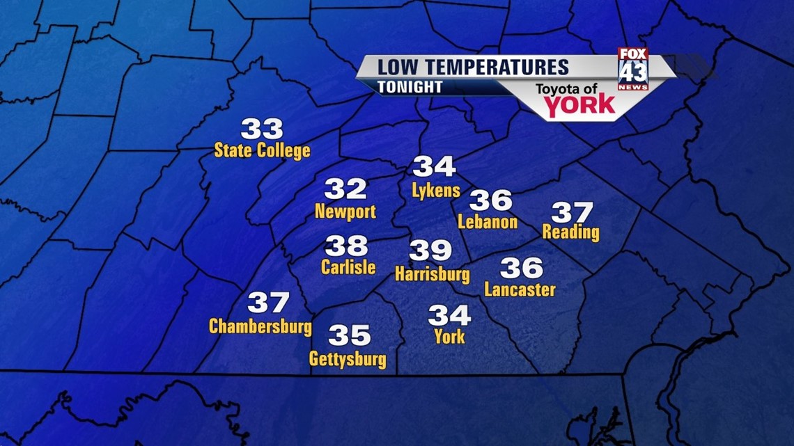
Colder air continues to pour into the area, and the Lower Susquehanna Valley begins the week well below average because of this. Frost Advisories continue for parts of the area tonight, and temperature sensitive plants will have to be monitored. With skies quickly clearly, low temperatures tumble into the middle to upper 30s. Even though Monday gets a sunny start, the cold air aloft bubbles up plenty of clouds during the afternoon hours. This keeps temperatures unseasonably chilly, with highs in the 50s area wide.
SLOWLY WARMING UP
Tuesday, we begin to warm, with plenty of sunshine still around. Highs bounce back into the 60s, but that is still below seasonable averages. By Wednesday, temperatures recover into the 70s, but a front hanging around the region could bring an isolated thunderstorm or two. Thursday a few storms are still possible, with warmer temperatures. Expect highs in the upper 70s to near 80 degrees.
VERY WARM WEEKEND
The weekend stays above average, with highs in the middle to upper 70s. Models are at opposing ends on where to put shower and thunderstorm chances, but for now we’ll call for a mainly dry period. A couple showers and thunderstorms are possible at times, but no day is going to be a washout by any means.
Have a great week!
-Andrea Michaels