

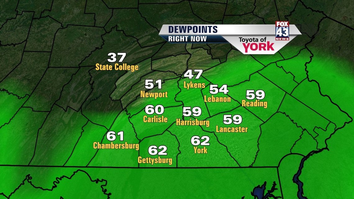
DRIER AIR CONTINUES TO SPILL SOUTH
Front continues to drop south and high pressure will shift our winds more north-northwesterly allowing drier air to move in. Dewpoints have been in the upper 50s to low 60s making it feel muggy but I am already seeing them drop in the 30s and 40s, an indication the drier air is working into the area. Clouds will continue to break up and clear the area allowing for temperatures to get pretty cool. Lows expected in the upper 40s to low 50s.
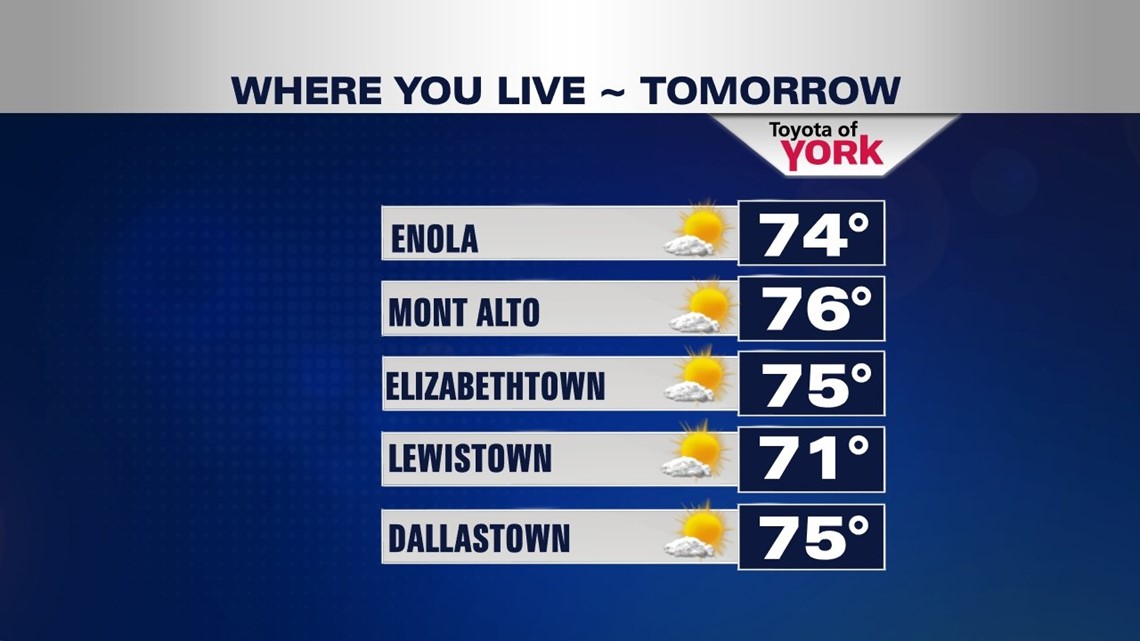
SUNNY AND SPLENDID FRIDAY
High pressure brings a fabulous end to the week. Sunny skies, light northerly breeze and temperatures in the low to mid 70s. Great weather heading into the weekend but some changes head our way as the winds shift more to the east-southeast.
–

QUESTIONABLE WEEKEND
Clouds will be returning on Saturday. There will be a chance for isolated showers and temperatures will be cooler in the low 70s. A persistent easterly flow will keep things cooler and unsettled. A warm front will slowly push back north Sunday bringing a better chance for scattered showers. Highs will not be able to get out of the 60s.

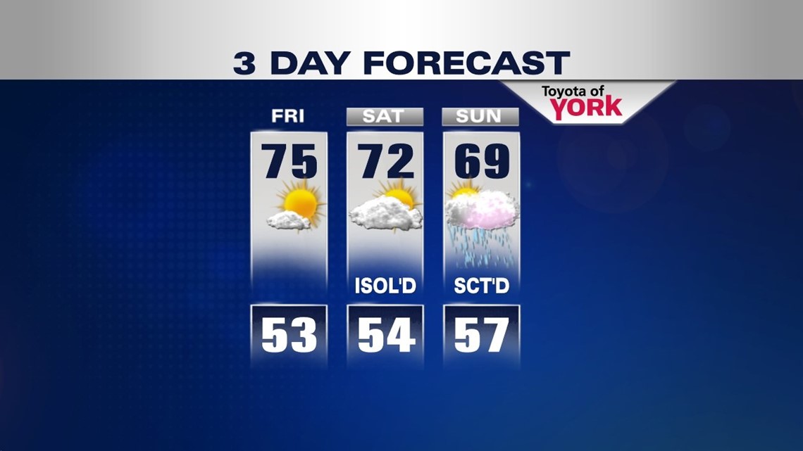
WARMER EARLY NEXT WEEK
Temperatures start to warm back up early next week as a ridge builds in with only an isolated threat for showers or thunderstorms each day as a cold front approaches. A better chance of widespread showers and thunderstorms holds off until Wednesday as the front gets much closer. Temperatures will be in the upper 70s to low 80s.
Hope you are enjoying your week.:)
MaryEllen Pann, Chief Meteorologist
Like me on Facebook: maryellenpannfox43
Follow me on Twitter: @MaryEllenFox43