
Showers and storms are winding down. Areas of fog will once again develop by morning. Overnight lows will be mild in the upper 60s.
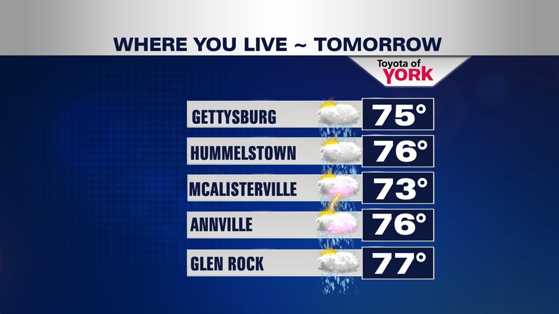
A strong cold front crosses the area tomorrow increasing our chances for showers and thunderstorms. It will be humid with highs in the upper 70s.

COOLER AND UNSETTLED FRIDAY
Models are now trending to a more unsettled pattern for Friday and even the start of the weekend. A trough slides in providing cooler air. Winds, instead of being out of the south-southwest, will be more northerly. Threat for a few showers may linger. The upper low can’t push east because of a ridge of high pressure in the Northern Atlantic. This means the clouds and possibly a few showers may hover into Saturday. Highs will be cooler in the mid 60s Friday. Overnight lows will dip into the 40s Saturday morning and rebound only to the upper 60s. We should see more sunshine and drier conditions by Sunday with highs around 72° despite 40s in the morning.
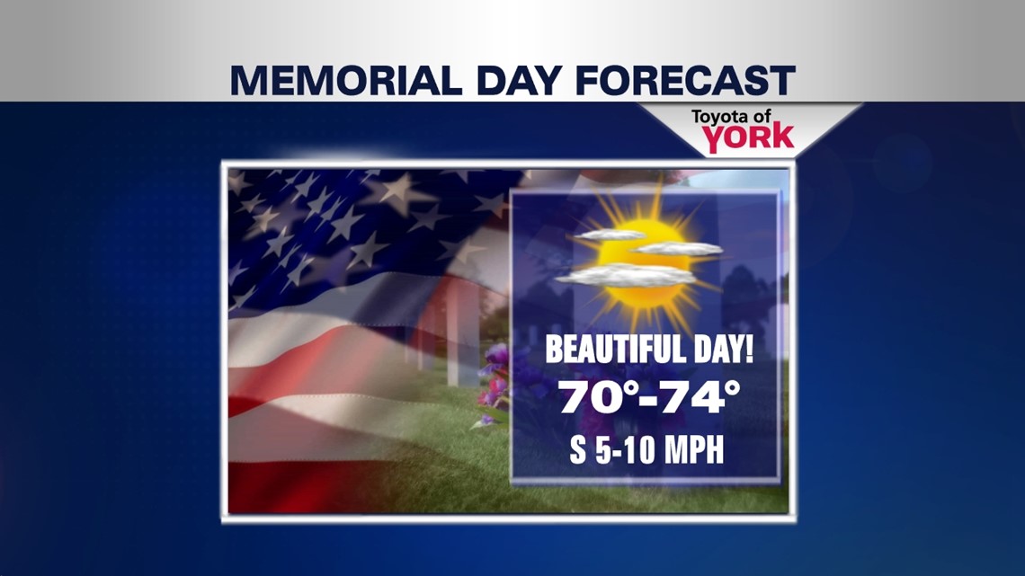
MEMORIAL DAY
The area should see plenty of sunshine for the holiday with highs warming into the low 70s. Memorial Day looks great for outdoor grilling, fishing, more importantly, remembering those who served and currently serve.

We start to warm back up Tuesday and Wednesday as a warm front pushes across the area but the threat for showers and storms will return. Highs expected in the upper 70s to around 80.
Hope you are enjoying your week.:)
MaryEllen Pann, Chief Meteorologist
Like me on Facebook: maryellenpannfox43
Follow me on Twitter: @MaryEllenFox43