
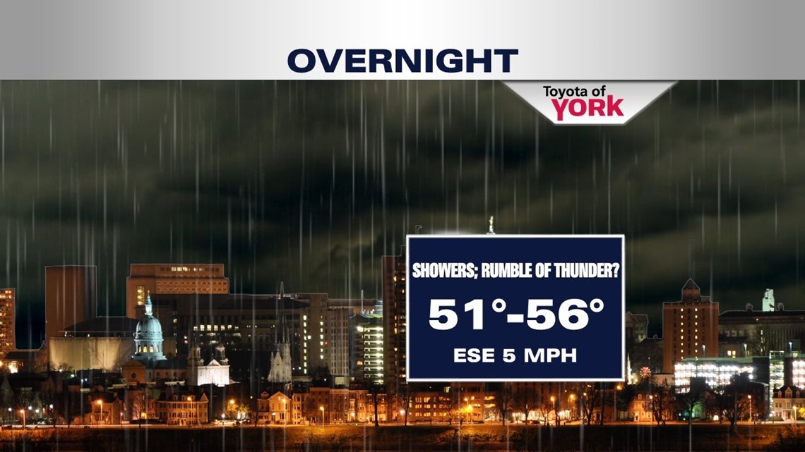
High clouds blanket the area this afternoon and evening. There could be an isolated shower this evening but most areas will remain dry. Temperatures will fall back into the low 60s. Overnight, the threat for showers increases after midnight as a warm front approaches plus, I can’t rule out a rumble of thunder. Lows will be in the low to mid 50s, milder than last several nights.


SHOWERY TUESDAY
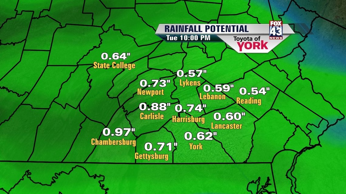
Warm front enters the area. You will feel the mugginess return. Showers likely early in the day then scattered showers and thunderstorms likely in the afternoon. Highs will reach the low 70s by afternoon despite the wet weather. It is possible the area could pick up .5” to .75” of rainfall.
WEDNESDAY WARM UP
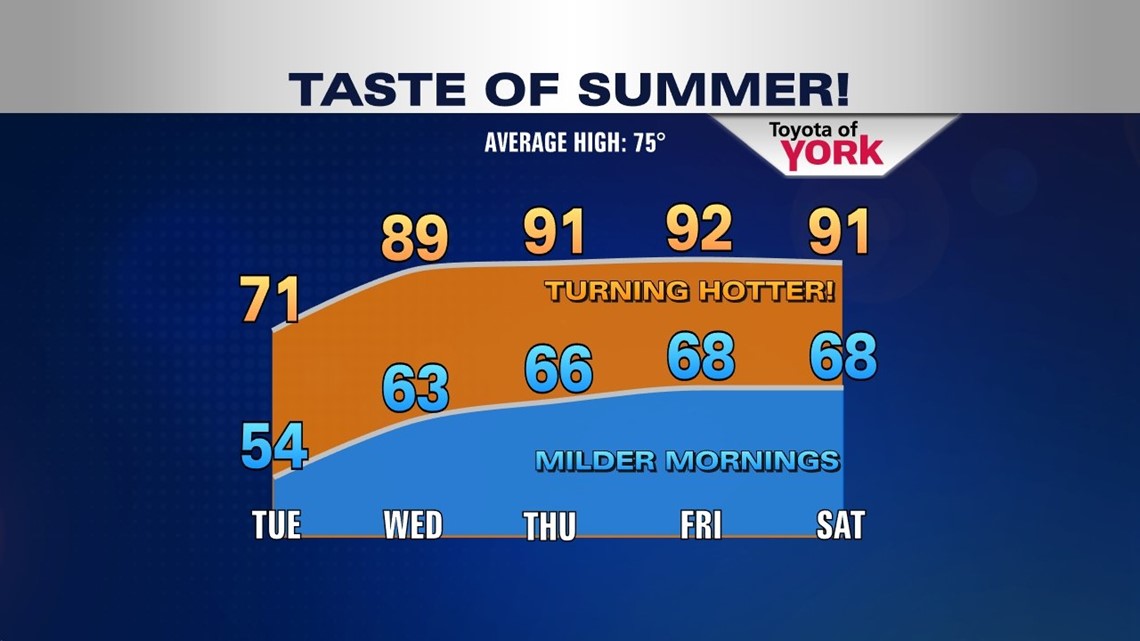
Warm front pushes north and allows warmer air to move in. There could still be an isolated threat for a shower or thunderstorm but most of the area will be dry with highs into the upper 80s. A little taste of summer starts things off for a few days.
FIRST HEAT WAVE OF THE SEASON?
We could see the first heat wave of the season. This means 3 days or more of 90 degree temperatures. A strong ridge of high pressure at the surface as well as in the upper levels really heats things up. It looks to get hot with highs hitting the low 90s Thursday, Friday and Saturday before a cold front slides in Sunday, knocking temperatures down and bringing a return of showers and thunderstorms. Models not agreeing on timing of front so we’ll have to watch and see how things change in the next few days.

MaryEllen Pann, Chief Meteorologist
Like me on Facebook: maryellenpannfox43
Follow me on Twitter: @MaryEllenFox43