
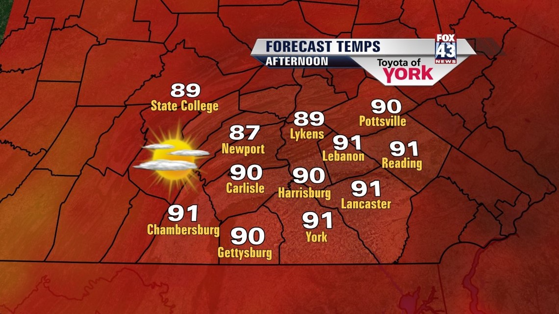
HEAT WAVE: After a preview day Wednesday, we’re now in the midst of a late May heat wave. We’re forecasting most spots to hit the 90° for the next three days, which meets the definition of a heat wave in central PA. An area of high pressure centered over Bermuda (known as the Bermuda high, go figure!) has expanded into the eastern U.S. and will be responsible for heating us up and squashing our rain chances. Are you ready to sweat it all out? I hope so!
For today, expect some light fog in spots early. Then, we rapidly warm to the upper 80s to near 90° by afternoon. Clouds will be few and rain chances are close to zero. The humidity is on too. Guess what? We’re just repeating this forecast for Friday and Saturday. Pool time!

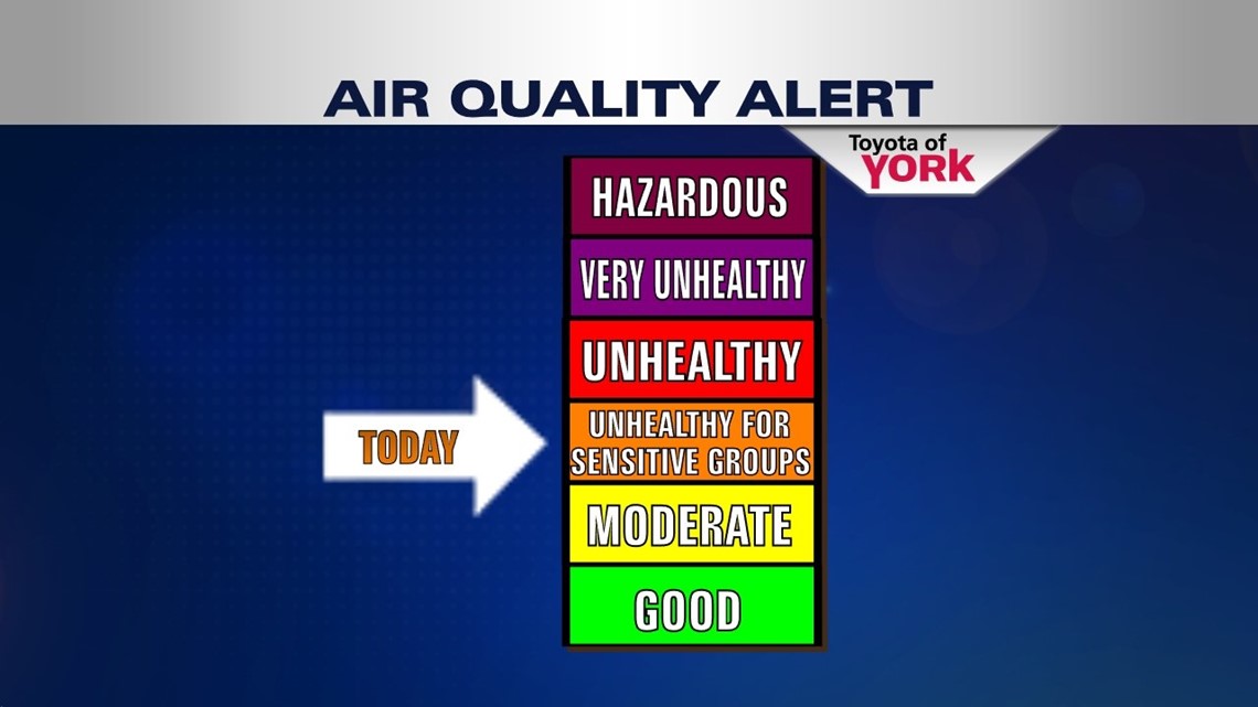
HEAT TIPS: The stuffy, stagnant air has put many of us under a code orange air quality alert for the day meaning those of you who are sensitive to air quality changes, like those with asthma or regular breathing problems, may have a tough time today. Also, with the high heat you want to make sure you don’t overdo it these next few days. Drink plenty of water, take frequent breaks, and find some shade or air conditioning. It’s best to get outdoor chores completed early morning or late evening, avoiding the most direct sun rays and hottest hours of the day from 10AM-3PM. Don’t forget to keep an eye on the kids, pets, and elderly who often don’t tolerate heat as well. Stay cool! Did I mention the pool yet? How about some ice cream too!

COLD FRONT: By Sunday, we start to see some changes. The Bermuda high shrinks and shoves east a bit as a cold front approaches the state. Expect another warm day, but this time highs are only in the middle 80s. Showers and storms will move in later in the day; some could be strong. Storms continue into Monday as the slow moving front progresses east. Temps will drop beginning Monday, back to near seasonal averages which puts us in the upper 70s. We’ll also take a break from the humidity too. This lasts through mid week.
Here’s to a terrific Thursday!
“It is never too late to be what you might have been.” – George Eliot
– Jeff Jumper, WPMT Fox43 Morning Meteorologist
Follow me on Twitter: @JeffJumperWX
Like me on Facebook: Jeff Jumper Fox43