

CHANGES COMING SUNDAY

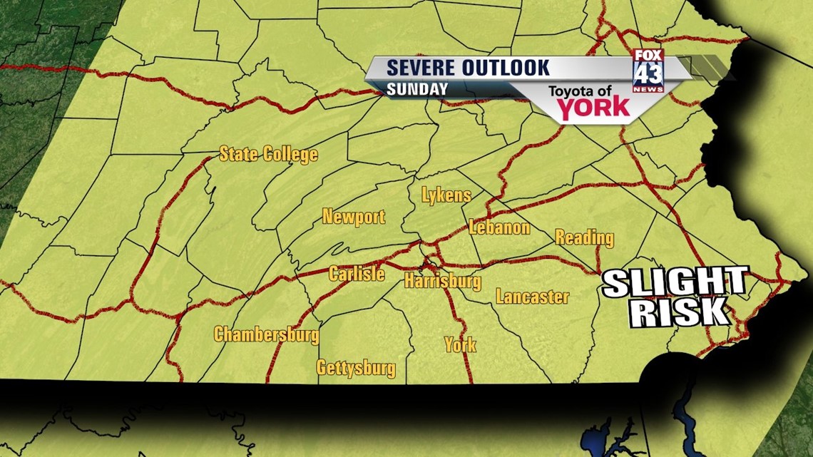
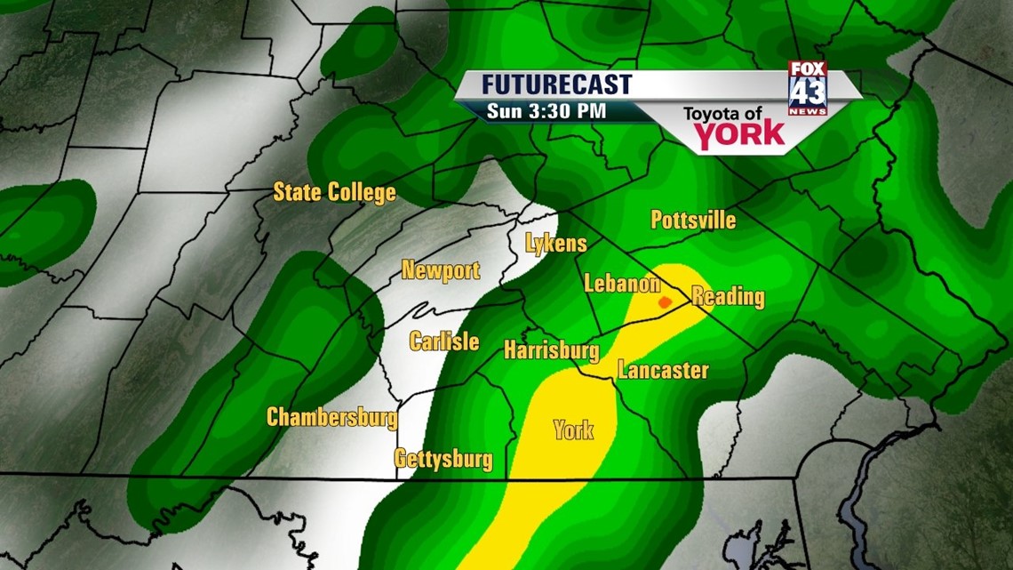
It’s official! It’s the first heat wave of the season for most, but it’s not going to last much longer. A cold front out west is heading this way. It brings lots of changes across the region. Tonight remains muggy and warm. Low temperatures only dip to near 70 degrees. Sunday, expect more by way of clouds. Temperatures reach the 80s across the area ahead of the front. Showers and thunderstorms pop up during the afternoon hours as the cold front approaches. The likelihood is very high that some storms turn strong to even severe. Damaging winds, hail, heavy downpours, and frequent lightning are the biggest threat with any storms that turn severe. The thunderstorm activity winds down during the evening hours. Some showers stick around into the overnight period.
MORE COMFORTABLE AIR ARRIVES
A cooler and less humid air mass rushes in behind the front on Monday. Highs only reach the middle to upper 70s under plenty of afternoon sunshine. Tuesday and Wednesday are still sunny courtesy of an area of high pressure. Highs are in the middle 70s. Even morning lows are cooler and more comfy! Readings dip into the 50s. It’s a breath of fresh air. Thursday clouds increase ahead of our next weather maker. Highs reach the upper 70s.
SHOWERY END TO THE WEEK
Expect unsettled conditions for the start of the weekend. Showers and thunderstorms return to the forecast Friday. Highs reach the upper 70s to near 80 degrees. Saturday more clouds and widespread showers and thunderstorms are likely. Highs stay in the 70s with the clouds and showers.
Enjoy the rest of your weekend!
-Andrea Michaels