

MORE RAIN FRIDAY

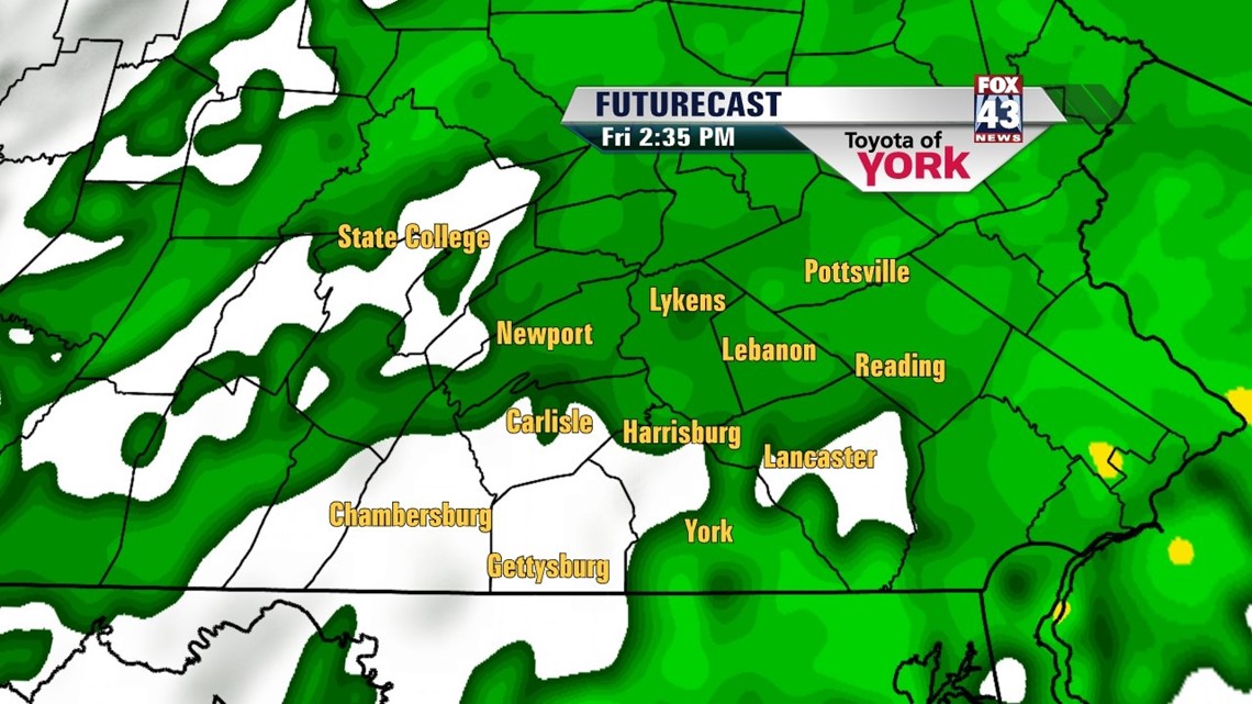
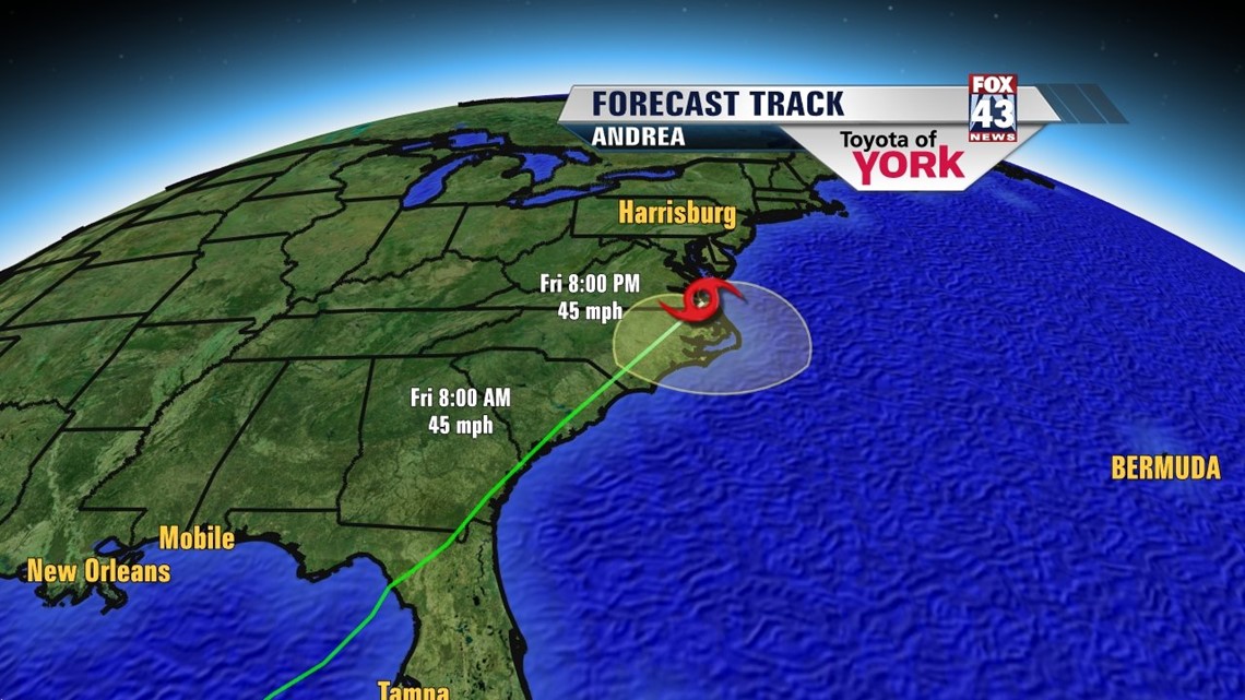
The combination of a cold front and Tropical Storm Andrea continues to pull in plenty of moisture across the Lower Susquehanna Valley. The heaviest rain during the morning aligns itself mainly east of I-83. Lighter, more scattered showers are found west. Heavy rain is still possible at times throughout the afternoon hours too. This keeps high temperatures in the upper 60s to lower 70s. Tonight the rain gradually tapers. Rainfall totals throughout the region range from 1 to 2 inches. Some locally higher amounts are possible.
GRADUALLY DRYING WEEKEND
The sun peeks out a bit in the wake of this system on Saturday. There’s still plenty of clouds though, and the chance for some showers and thunderstorms. High temperatures are close to 80 degrees. Readings for everyone reach the lower to middle 80s on Sunday. More is expected by way of sunshine. There is a small chance, however, for a thunderstorm.
UNSETTLED ONCE AGAIN
Another cold front comes this way Monday. This brings more widespread showers and thunderstorms back into the mix. Highs are back into the 80s. The front will takes its time passing through. This means another day with a shower and thunderstorm chance for us. High temperatures are near the 80 degree mark. A mixture of sunshine and clouds is slated for Wednesday. A warm front adds more clouds Thursday. Temperatures are expected to hover near or just above seasonable average.
Have a great Friday!
-Andrea Michaels