

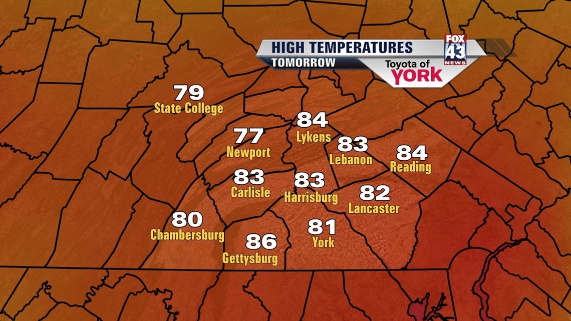
PLEASANT END TO THE WEEKEND

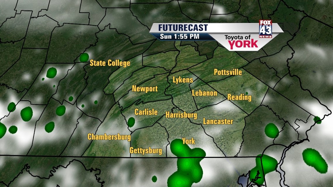
Clearing skies this afternoon have allowed the sunshine to poke out throughout the region. A few clouds remain through the overnight period. It’s a comfortable night with lows in the upper 50s to near 60 degrees. Sunday expect partly sunny skies ahead of an approaching storm system. There’s a small chance for an isolated shower or thunderstorm late in the day. The clouds also quickly increase at this point. Highs reach the upper 70s to lower 80s throughout the region.
UNSETTLED START TO THE WEEK
This storm system’s warm front brings showers overnight Sunday through Monday. Even a few thunderstorms are possible Monday afternoon. Highs are near 80 degrees. Limited sunshine could keep many in the 70s. Tuesday is still unsettled as the system continues to cross the area. A few showers and thunderstorms are still possible. Highs are once again near the 80 degree mark. By Wednesday, skies clear out a bit with highs once again near 80.
DRYING OUT BY WEEK’S END
Thursday another system dives just to our south. It will track close enough to bring showers into the forecast. Highs are stuck in the 70s. Friday brings a mixture of sunshine and clouds across the Lower Susquehanna Valley. Wall to wall sunshine returns Saturday. High temperatures both days hover near or just above 80 degrees.
Enjoy the rest of your weekend!
-Andrea Michaels