

ONE MORE COMFORTABLE NIGHT
Expect another great night after a slightly milder Friday across the Lower Susquehanna Valley. Skies are mainly clear. Humidity levels still remain in the comfort zone. Lows fall into the upper 50s to lower 60s throughout the region.
TURNING UP THE HEAT

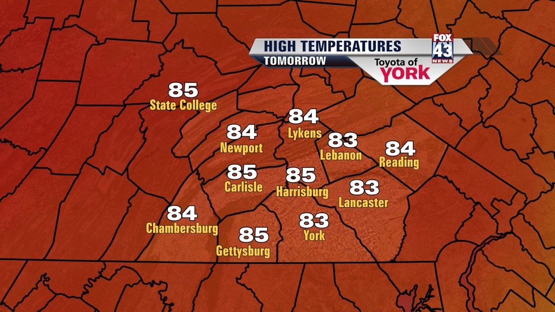
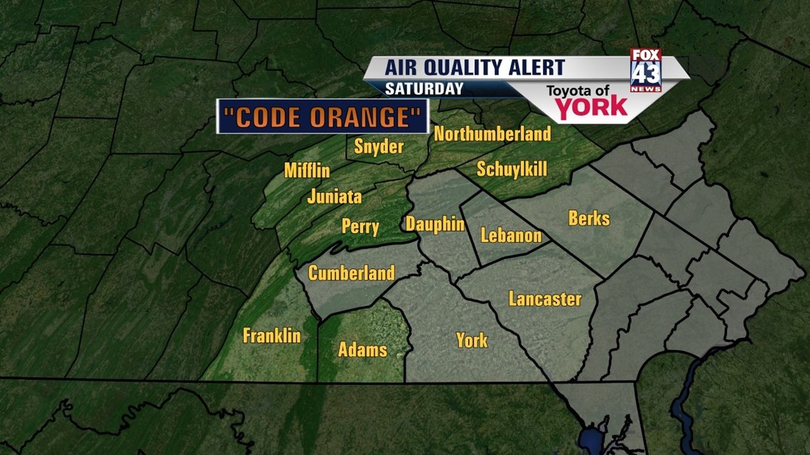
Temperatures continue to warm into the first weekend of summer. This is courtesy of a strong ridge of high pressure that will be gaining strength into next week. Saturday reaches the middle to upper 80s under plenty of sun. The humidity also begins to creep up Saturday afternoon. An Air Quality Alert is in effect once again for Saturday. Be sure to take it easy if you fall into one of the sensitive lung groups! The humidity is back in full force overnight Saturday, and it’s here to stay. Sunday highs touch the 90 degree mark for most. This starts the first day of another possible heat wave. An isolated thunderstorm is possible but most stay dry. Monday is much of the same, with slightly warmer temperatures.
BREAKING THE HEAT
Tuesday and Wednesday highs are in the lower 90s for most. The hazy, hot, and humid conditions continue. There is still the chance for a few isolated thunderstorms to pop up. By Thursday, our next storm system approaches. Its timing during the afternoon will determine if the 90 degree streak breaks or waits until Friday. Expect scattered showers and thunderstorms lasting into Friday. Highs cool into the 80s Friday.
Have a great weekend!
-Andrea Michaels