
FLASH FLOOD WATCH has been cancelled!
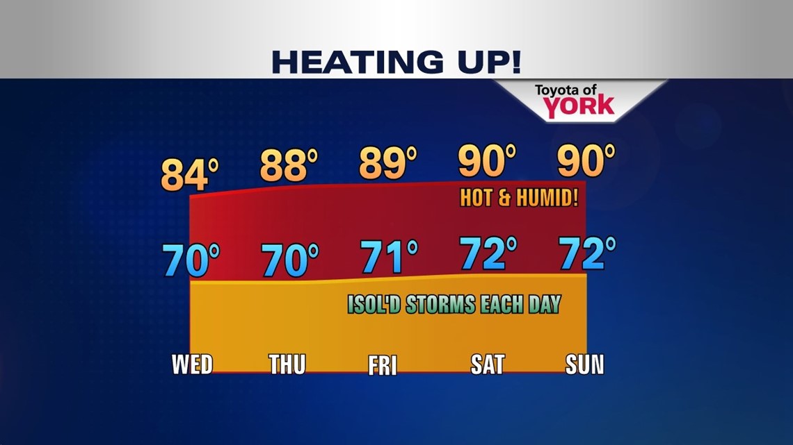
A slow moving and strong upper level low continues to slowly migrate westward but is still streaming warm and humid air into the Lower Susquehanna. A Bermuda High in the Atlantic is beginning to strengthen and take more control decreasing our chances for rain as we head into the end of the week. Daily isolated threat for showers and storms will continue into next week. Temperatures will be getting hotter as the ridge of high pressure builds. This means temperatures will be flirting with 90 degrees for several days through the weekend and beyond.
Dewpoints will remain very high the next several days. Here is a look at current readings.


Very warm and humid conditions persist in to the night. Isolated showers, perhaps an isolated thunderstorm will linger overnight. Early morning for the commute, there could be hit or miss showers, some heavy as well as areas of fog. It will be pretty sticky with lows in the upper 60s to low 70s.
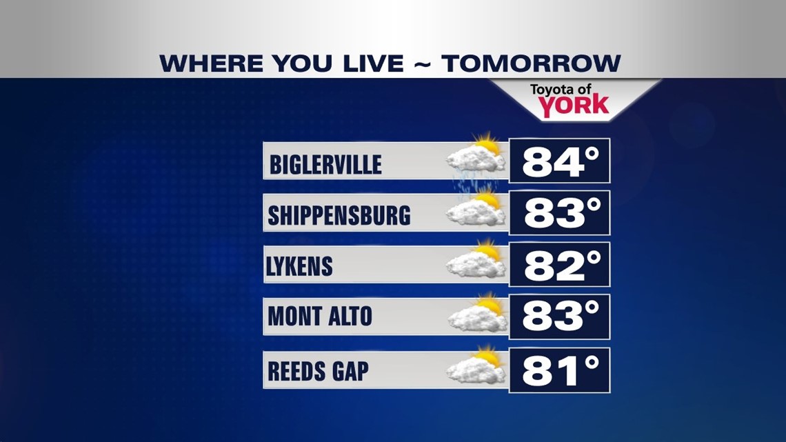
Tomorrow, there will still be a threat for hit or miss showers with thunderstorm chances in the afternoon. Some could contain locally very heavy rainfall. Highs will be in the low 80s once again.

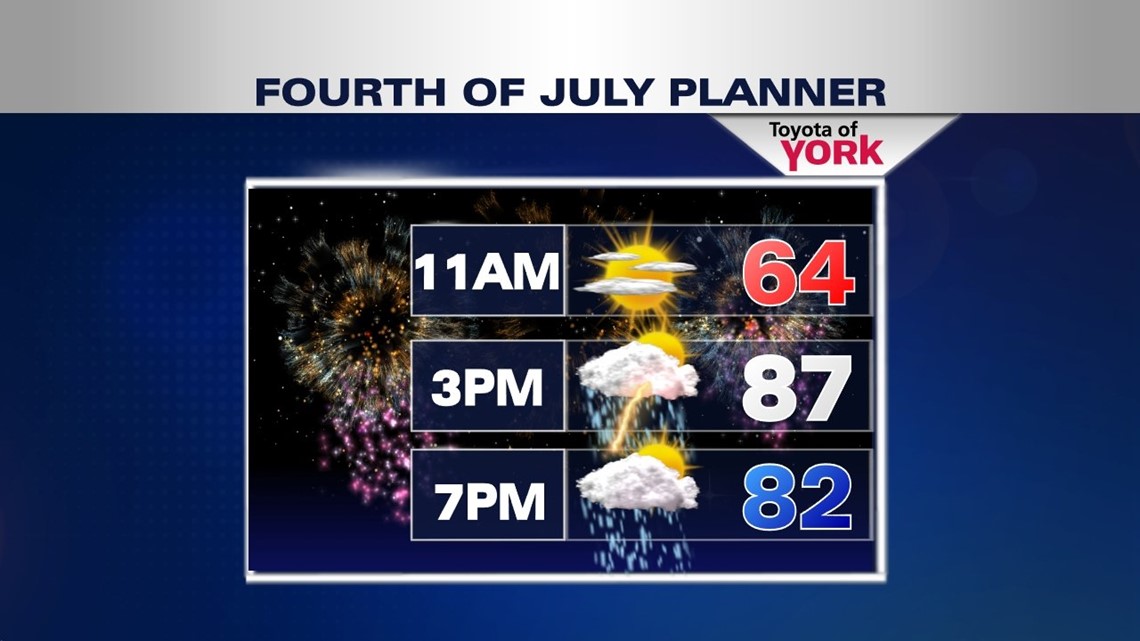
Right now Fourth of July looking at more dry hours than not. Only an isolated threat for showers and storms expected. It will be warm and humid with highs around 87.

RETURNING TO THE 90s!

MaryEllen Pann, Chief Meteorologist
Like me on Facebook: maryellenpannfox43
Follow me on Twitter: @MaryEllenFox43