
Bermuda High sitting pretty in the Atlantic. It has helped to push most of the shower and storm activity to the west. However, there are still some storms popping up in Franklin, Cumberland and Perry Counties at this hour. We’ll see a daily threat for isolated showers & storms all the way through next week.
Sunday into Monday a strong disturbance and associated trough swings in. It will knock temps back into the upper 80s and also bring the best chance for scattered showers and storms mainly Sunday into Sunday night. This will also lead to a more zonal flow in the upper levels late Monday into Thursday. Temperatures will rebound to near 90 with only an isolated threat for showers and storms each day.
For fireworks tonight, there could be a stray shower or thunderstorm but once the sun sets the threat will diminish. Most everyone will have dry conditions for the holiday display. Winds will lighten up as well. Temperatures will be warm in the low 80s to start then will fall back into the mid 70s heading towards midnight.


Overnight, mostly clear, warm and muggy with lows in the low 70s.

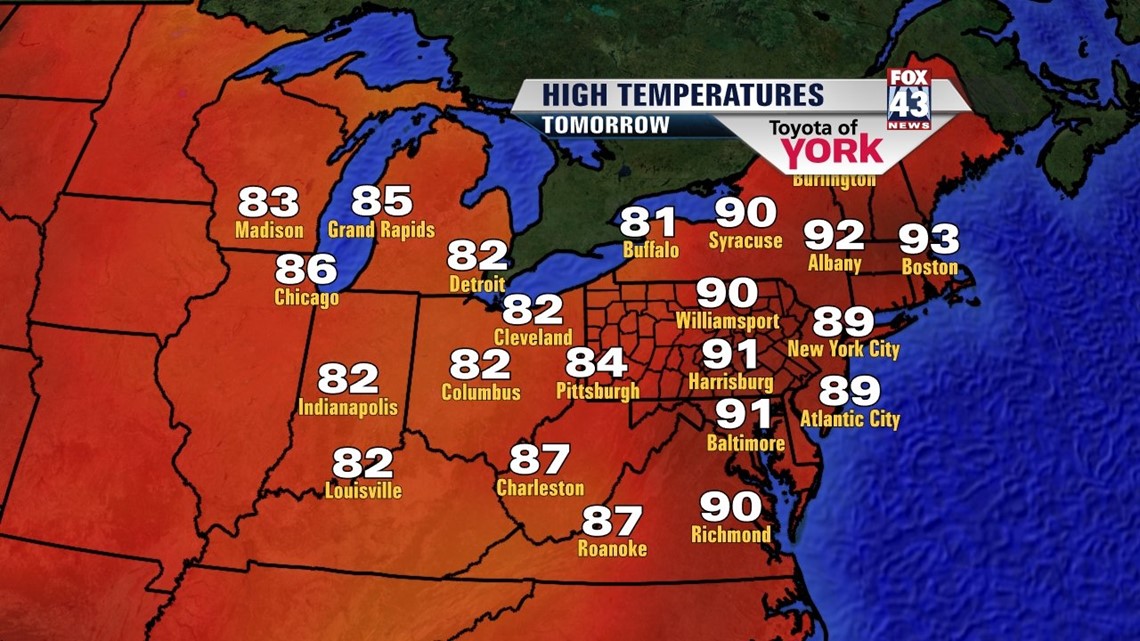
We’ll end the week with plenty of hazy sunshine and our least chance for rain. It looks to be the best day to remain dry. Highs will be warm as temperatures climb to around 90°.
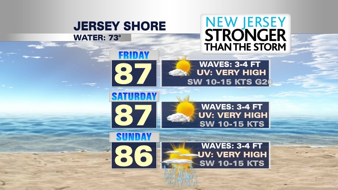
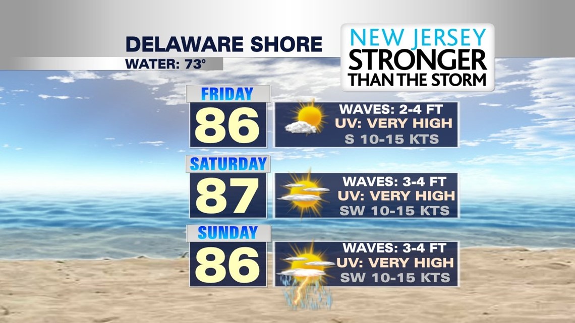
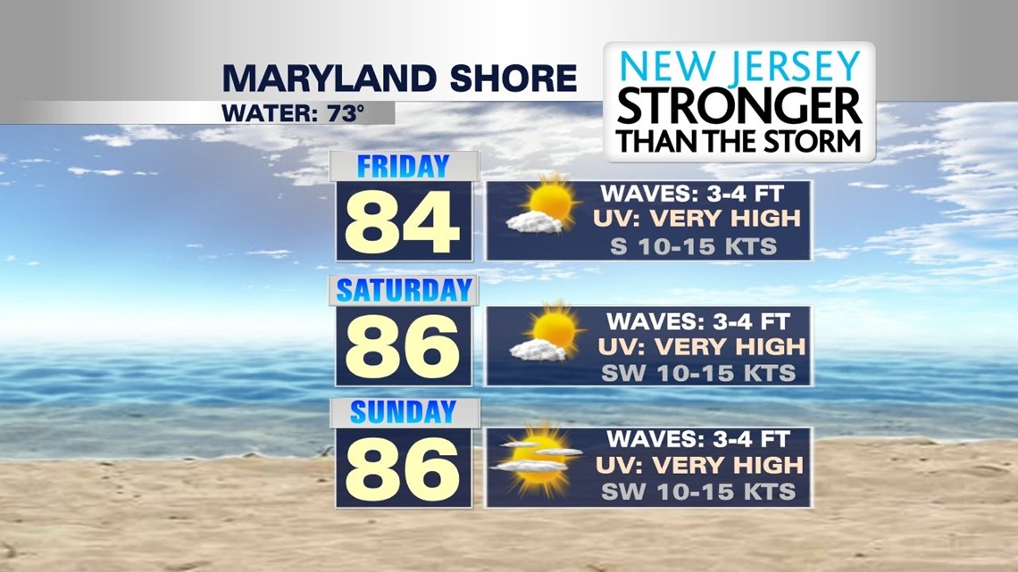
Heading to the beaches, here is a look at what you can expect. Pretty decent weather for those of you heading east for the holiday weekend! Plenty of sunshine, breezy with highs in the mid to upper 80s.


MaryEllen Pann, Chief Meteorologist
Like me on Facebook: maryellenpannfox43
Follow me on Twitter: @MaryEllenFox43