

THE HEAT IS BACK

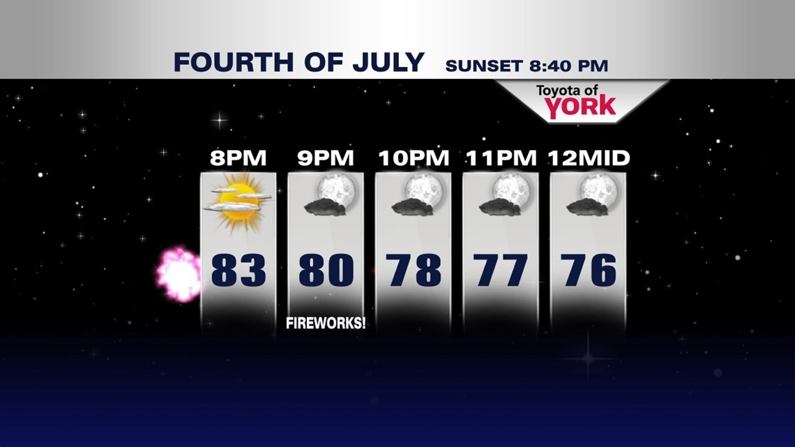
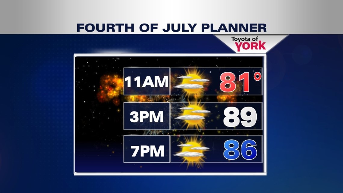
The heat returns to the Lower Susquehanna Valley today, along with a lessening thunderstorm chance. A Bermuda area of high pressure begins taking control of our weather on Thursday. It pushes the unsettled upper level pattern west, forcing it to retrograde. This means the heat returns and the thunderstorm chance becomes isolated. The best chance for any thunderstorms is in our far western counties. So for most, the Fourth of July holiday is looking dry, but hot and humid. Even better, the fireworks forecast is looking dry too! Highs reach the upper 80s to near 90 degrees.
MUCH DRIER
The hot pattern settles across the region into next week. Expect the heat and humidity to stay! Friday looks like the first completely dry day we’ve had in quite a while. The hot July sun boosts temperatures into the upper 80s to lower 90s. Saturday an isolated thunderstorm chance returns. Highs are once again in the lower 90s. A weak upper level piece of energy heads this way Sunday, bringing a more widespread shower and thunderstorm chance to the region. There is the possibility some of these storms could be on the stronger side. Otherwise, high temperatures fall back into the middle to upper 80s.
HOT THROUGH NEXT WEEK
The hot and humid conditions are here to stay for quite some time. Highs hover near 90 degrees through next Wednesday. An isolated thunderstorm chance is also present each day. Remember to stay cool through the next 7 days!
Have a great Fourth of July!
-Andrea Michaels