

REMAINING MUGGY AND UNSETTLED!

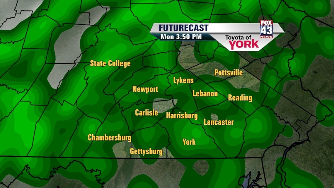
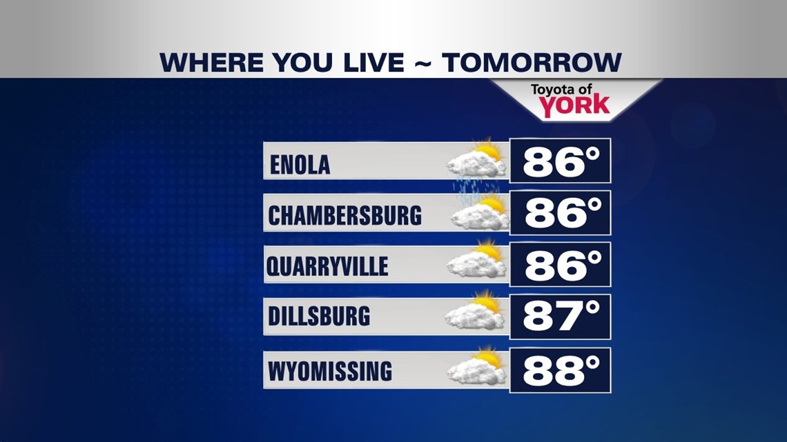
After a stormy Sunday afternoon, conditions are quiet through the overnight period. Some showers dwindle through the evening, leaving only a few showers for the rest of the night. With the ground wet from the showers, patchy fog develops late. Temperatures won’t fall much more, and bottom out in the upper 60s to lower 70s. Monday, the same piece of energy that brought today’s storms exits the region. This should still bring scattered showers and storms during the afternoon hours. Some could be on the stronger side again. High temperatures reach the middle to upper 80s. The warm and humid conditions are here to stay for a few more days. Highs hover near 90 degrees Tuesday and Wednesday. A thunderstorm chance is also present each day.
BRIEF RELIEF IN SIGHT
Some much needed relief from the humidity is on the way Thursday! A cold front approaches the region, bringing the chance for scattered showers and thunderstorms. Highs fall back into the middle 80s. More importantly, this cold front temporarily breaks the humidity! Finally!
SAY IT ISN’T SO?
It seems like another strong blocking area of high pressure forms in the Atlantic by the end of the week. What does this mean for us on the East Coast? Since weather systems normally move from west to east, it means Thursday’s system might not be able to continue its easterly progress. So it could get stuck right over the eastern United States and keep us unsettled. The humidity is temporarily broken, and we stay seasonal and dry for Friday. By Saturday and Sunday, however, some humidity and unsettled conditions return. Expect highs to hover in the middle 80s.
Have a great week!
-Andrea Michaels