
We get somewhat of a break from the heat but the humidity, while not as oppressive as the weekend, remains for several days. Temperatures will stay around seasonal averages or just above. High pressure off the east coast is still funneling very warm and humid conditions like we have experienced for over a week now. Don’t see much relief until a cold front comes in Thursday and brings drier air behind it.
Tonight, shower and storm threat will end during the evening for a several hours before the chance returns in the morning. Lows will dip into the upper 60s.
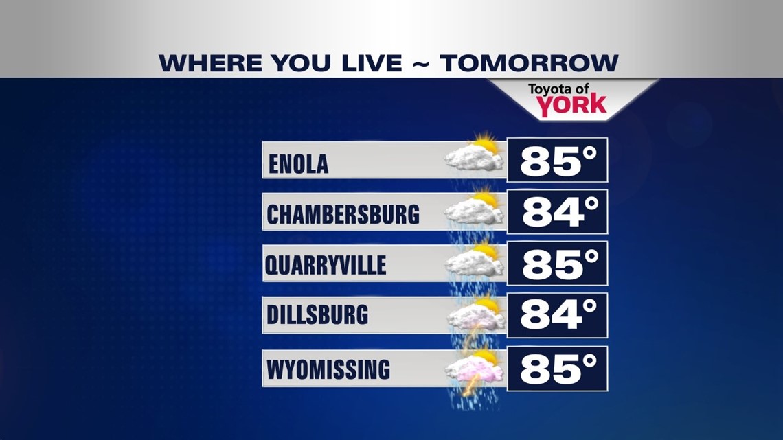
A storm complex currently swinging through Indiana will ride in here early in the morning. It could bring a few showers for some during the morning commute. We then get a break before showers and storms return in the early afternoon. Highs tomorrow will reach the mid 80s.

An upper level disturbance out ahead of a cold front will arrive Wednesday before the front comes in early Thursday. Showers and storms will be possible again Wednesday as the unsettled weather continues. Temperatures will be warmer in the upper 80s. Storms will be likely into the evening and overnight as a cold front comes in right behind the short wave. It will be muggy and mild with lows in the lower 70s.
Showers and storms possible early Thursday as the front clears the area by afternoon. Highs will be in the mid 80s under clearing skies late in the day.
For Friday, drier air settles in briefly and a dip in the jet stream will allow temperatures to be cooler and a tad below average in the low 80s.
Our break from the heat and humidity will be short-lived as the trough lifts and ridge sets up once again over the east coast just like the past week or so. This means daily threat for showers and storms, humid days and highs hovering at or above average in the mid to upper 80s.
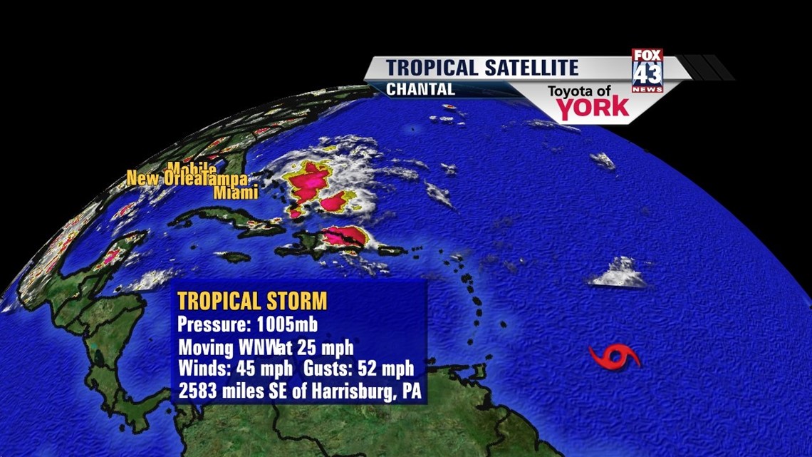
We are also watching a system in the tropics. “CHANTAL” is forecast to possibly move just off the southeast coast of Florida by the weekend.

MaryEllen Pann, Chief Meteorologist
Like me on Facebook: maryellenpannfox43
Follow me on Twitter: @MaryEllenFox43