
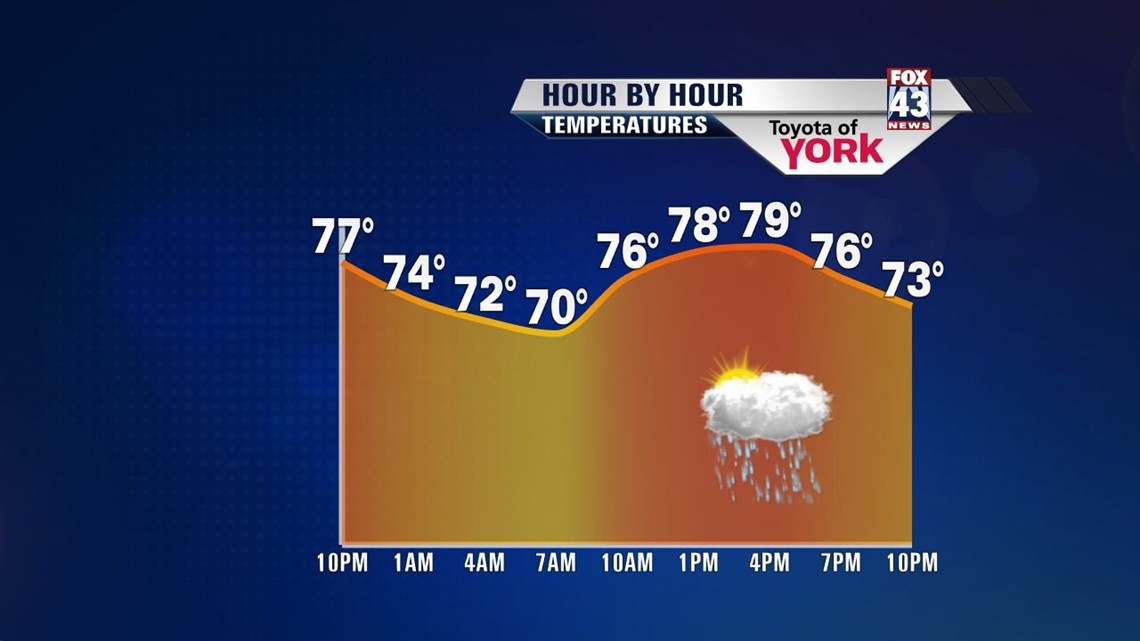
A cold front will stall south of the state tonight. We’ll get to enjoy cooler, less humid air. Mainly dry conditions heading to the evening with temperatures falling into the upper 70s. Best chance for showers will be isolated and concentrated to the south.
Overnight, the front will migrate back to the north a bit keeping the threat for a few showers mainly in our southern counties like Franklin, Adams, York and southern Lancaster. Lows will be more seasonal in the mid 60s.

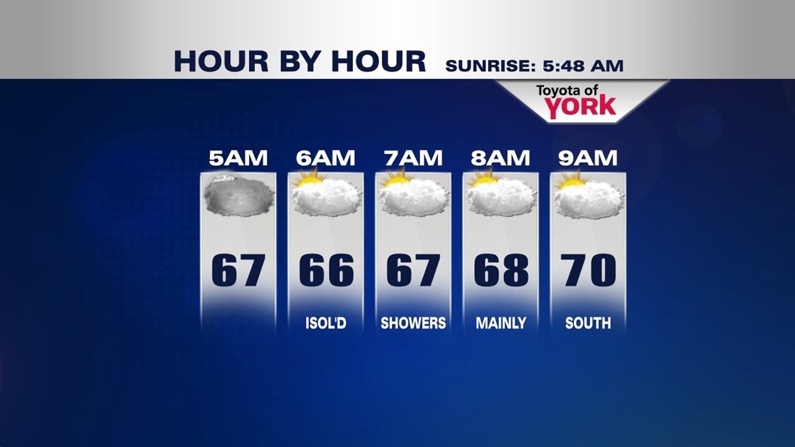
We end the week with mainly overcast skies as an upper level low moves just to our west. That feature in combination with the front will keep the threat for a few showers in the forecast. Most of the day and the area could go without seeing any rain. Chances are about 30 to 40% any one area could see showers. Highs will be much, much cooler reaming in the upper 70s.

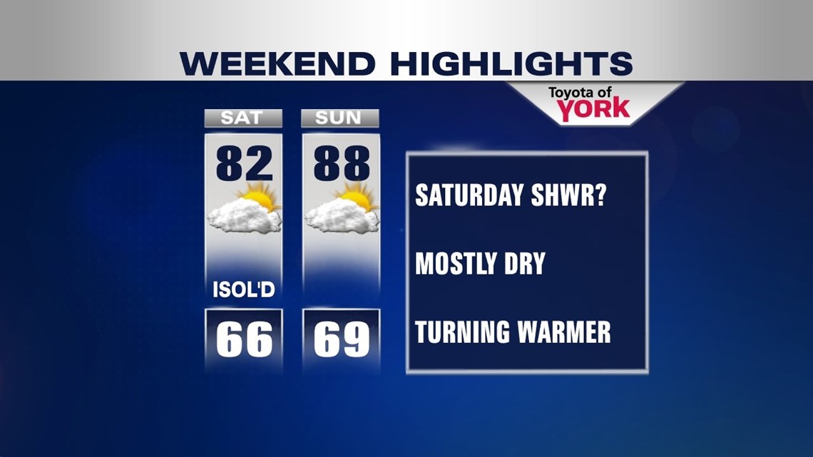
The upcoming weekend will feature a huge warm up by Sunday. Still seeing the clouds and a few isolated showers Saturday and highs running below average in the low 80s but by Sunday, a ridge of high pressure is expected to build in and hold strong for much of the upcoming week. This means a return of the heat and humidity with highs flirting with 90 and daily isolated storm threat.

Looks like a front drops south on Thursday which could trigger scattered showers and thunderstorms but it remains very warm with highs in the upper 80s to around 90.
MaryEllen Pann, Chief Meteorologist
Like me on Facebook: maryellenpannfox43
Follow me on Twitter: @MaryEllenFox43